Area Overview for HA2 9QJ
Photos of HA2 9QJ
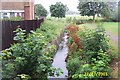
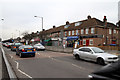
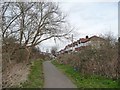
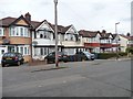
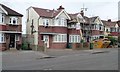
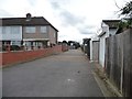
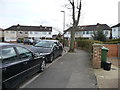
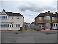
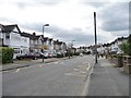
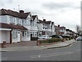
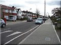
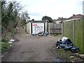
34 photos from this area
Area Information
Key information about the HA2 9QJ including its size, population, and administrative classification.
- Area Type
- Postcode
- Area Size
- 1.6 hectares
- Population
- 1773
- Population Density
- 9774 people/km²
House Prices in HA2 9QJ
37
Properties
£380,850
Average Sold Price
£116,000
Lowest Price
£675,000
Highest Price
Showing 37 properties
| Address | Type | Beds | Baths | Last Sale Price | Last Sale Date | |
|---|---|---|---|---|---|---|
| 108 Torbay Road, South Harrow, HA2 9QJ | Terraced | 4 | 2 | £605,000 | Jun 2024 | |
| 100 Torbay Road, South Harrow, HA2 9QJ | Terraced | 5 | 2 | £675,000 | Mar 2023 | |
| 120 Torbay Road, South Harrow, HA2 9QJ | house | - | - | £635,000 | Jun 2021 | |
| 88 Torbay Road, South Harrow, HA2 9QJ | house | 3 | 1 | £540,000 | Mar 2021 | |
| 136 Torbay Road, South Harrow, HA2 9QJ | Semi-detached | 5 | 2 | £592,000 | Oct 2020 | |
| 106 Torbay Road, South Harrow, HA2 9QJ | Terraced | 3 | 1 | £522,500 | Oct 2017 | |
| 138 Torbay Road, South Harrow, HA2 9QJ | house | 5 | - | £585,000 | Sep 2015 | |
| 112 Torbay Road, South Harrow, HA2 9QJ | house | 3 | 1 | £410,000 | Aug 2015 | |
| 124 Torbay Road, South Harrow, HA2 9QJ | Semi-detached | 4 | - | £485,000 | May 2015 | |
| 84 Torbay Road, South Harrow, HA2 9QJ | house | 3 | - | £417,000 | Jan 2015 |
Page 1 of 4
Energy Efficiency in HA2 9QJ
Amenities
Schools
| Rank | School | Type | Entry gender | Ages |
|---|
Explore more schools in this area
Go to Schools tabDemographics
Household Size
Family (3-5 people)
most common
Accommodation Type
Houses
most common
Tenure
77
majority
Ethnic Group
asian_total
most common
Religion
N/A
most common
Household Composition
N/A
most common
Age
47
median
Adults (30-64 years)
most common
Household Deprivation
N/A
with no deprivation
NS-SEC
32
in Lower managerial occupations
Explore more demographic insights in this area
Go to Demographics tabPlanning
Planning Constraints
- Flood RiskPremium
- Ramsar Wetland SitesPremium
- Area of Outstanding Natural BeautyPremium
- Protected Nature ReservePremium
- Protected WoodlandPremium