Area Overview for HA2 9NB
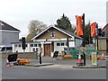
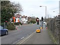
Photos of HA2 9NB


Area Information
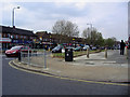
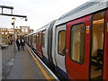
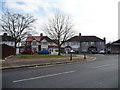
HA2 9NB is a small, tightly knit residential postcode in England, home to 1881 people. Its compact size means it feels like a quiet, established community rather than a sprawling suburb. The area is defined by its proximity to key transport links, including Rayners Lane Station and South Harrow Station, which connect residents to London’s broader rail network. Daily life here balances convenience with tranquillity: local shops such as Tesco Rayners and Sainsburys Rayners cater to everyday needs, while nearby parks and open spaces offer respite. The median age of 47 suggests a mature demographic, with many residents in their prime working years. This is a place where stability and practicality are prioritised, reflected in the low crime risk and minimal environmental hazards. For those seeking a peaceful yet connected lifestyle, HA2 9NB offers a blend of accessibility and calm, with homes predominantly in single-family structures. It’s a postcode where familiarity with the surroundings is key, and the small population fosters a sense of community.
- Area Type
- Postcode
- Area Size
- Not available
- Population
- 1881
- Population Density
- 10562 people/km²
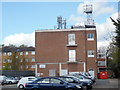
HA2 9NB’s property market is characterised by a 41% home ownership rate, meaning nearly half of the housing stock is rented. This suggests a mix of owner-occupied and rental properties, though the exact proportion of each is not specified. The predominant accommodation type is houses, which may indicate a focus on family homes rather than apartments or terraced properties. Given the area’s small size, the housing stock is likely limited, making it a niche market for buyers. The presence of multiple transport links, including Rayners Lane Station and nearby rail networks, could enhance the appeal of properties here, particularly for commuters. However, the low home ownership rate might reflect a reliance on rental options or a transient population. Buyers should consider the local market’s dynamics, as the limited number of properties could mean competition for available homes.
House Prices in HA2 9NB
No properties found in this postcode.
Energy Efficiency in HA2 9NB
Living in HA2 9NB offers a blend of convenience and accessibility. The area is served by five retail outlets, including major chains like Tesco Rayners, Iceland Rayners, and Sainsburys Rayners, ensuring everyday shopping needs are met locally. Transport links are extensive, with five metro stations, five rail stations, and access to RAF Northolt airport nearby. This makes commuting to London or other parts of the country straightforward. While specific parks or leisure facilities are not detailed in the data, the proximity to stations like Eastcote and Harrow suggests nearby green spaces or recreational areas. The variety of transport options and retail choices contributes to a practical, efficient lifestyle. Residents can enjoy the benefits of a small community while having access to the amenities of a larger urban area, making HA2 9NB a balanced choice for those prioritising convenience and connectivity.
Amenities
Schools
| Rank | School | Type | Entry gender | Ages |
|---|
Explore more schools in this area
Go to Schools tabDemographics
The community in HA2 9NB is predominantly composed of adults aged 30–64, with a median age of 47. This suggests a population largely in their working years, likely with established careers and families. Home ownership stands at 41%, indicating a mix of owner-occupied properties and rental homes. The accommodation type is primarily houses, which may reflect a preference for more space compared to flats. The predominant ethnic group is Asian_total, highlighting the area’s cultural diversity. While specific deprivation data is not provided, the low crime risk score of 82/100 implies a relatively safe environment, which can positively influence quality of life. The population size of 1881 means the area is small enough to feel close-knit but large enough to support essential services. This demographic profile suggests a community that values stability, with a balance between family-oriented living and individual independence.
Household Size
Accommodation Type
Tenure
Ethnic Group
Religion
Household Composition
Age
Household Deprivation
NS-SEC
Explore more demographic insights in this area
Go to Demographics tabPlanning
Planning Constraints
- Flood RiskPremium
- Ramsar Wetland SitesPremium
- Area of Outstanding Natural BeautyPremium
- Protected Nature ReservePremium
- Protected WoodlandPremium