Area Overview for HA2 9HD
Photos of HA2 9HD
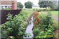
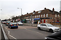
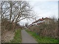
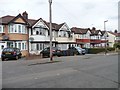
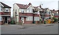
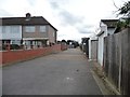
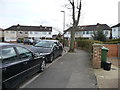
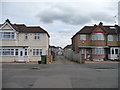
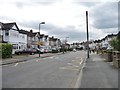
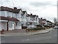
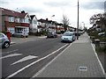
34 photos from this area
Area Information
Key information about the HA2 9HD including its size, population, and administrative classification.
- Area Type
- Postcode
- Area Size
- 4276 m²
- Population
- 1909
- Population Density
- 10541 people/km²
House Prices in HA2 9HD
16
Properties
£429,056
Average Sold Price
£241,000
Lowest Price
£700,000
Highest Price
Showing 16 properties
| Address | Type | Beds | Baths | Last Sale Price | Last Sale Date | |
|---|---|---|---|---|---|---|
| 178 Malvern Avenue, South Harrow, HA2 9HD | Terraced | 3 | 2 | £600,000 | Dec 2025 | |
| 188 Malvern Avenue, South Harrow, HA2 9HD | Semi-detached | 2 | 1 | £450,000 | Feb 2024 | |
| 182 Malvern Avenue, South Harrow, HA2 9HD | Terraced | 3 | 1 | £467,500 | Mar 2023 | |
| 166 Malvern Avenue, South Harrow, HA2 9HD | Terraced | 5 | 3 | £700,000 | Dec 2022 | |
| 172 Malvern Avenue, South Harrow, HA2 9HD | house | - | - | £283,000 | Sep 2022 | |
| 186 Malvern Avenue, South Harrow, HA2 9HD | Terraced | 4 | - | £510,000 | Jun 2017 | |
| 180 Malvern Avenue, South Harrow, HA2 9HD | Terraced | - | - | £241,000 | Jan 2009 | |
| 176 Malvern Avenue, South Harrow, HA2 9HD | house | 3 | - | £345,000 | Nov 2007 | |
| 184 Malvern Avenue, South Harrow, HA2 9HD | Terraced | - | - | £265,000 | Jun 2007 | |
| 188 Malvern Avenue, South Harrow, HA2 9HD | undefined | - | - | - | - |
Page 1 of 2
Energy Efficiency in HA2 9HD
Amenities
Schools
| Rank | School | Type | Entry gender | Ages |
|---|
Explore more schools in this area
Go to Schools tabDemographics
Household Size
Family (3-5 people)
most common
Accommodation Type
Houses
most common
Tenure
59
majority
Ethnic Group
asian_total
most common
Religion
N/A
most common
Household Composition
N/A
most common
Age
47
median
Adults (30-64 years)
most common
Household Deprivation
N/A
with no deprivation
NS-SEC
26
in Lower managerial occupations
Explore more demographic insights in this area
Go to Demographics tabPlanning
Planning Constraints
- Flood RiskPremium
- Ramsar Wetland SitesPremium
- Area of Outstanding Natural BeautyPremium
- Protected Nature ReservePremium
- Protected WoodlandPremium