Area Overview for HA2 8SQ
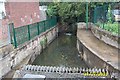
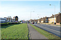
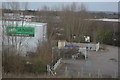
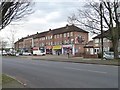
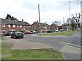
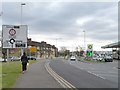
Photos of HA2 8SQ
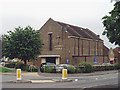

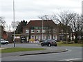
![Housing on the Brackenhill site [1] in HA2 8SQ](https://images.propbar.co.uk/images/geograph/48/60/4860770_120.jpg)
Area Information
Living in HA2 8SQ means being part of a compact, residential postcode area in England with a population of just 1,794. This small cluster of homes is characterised by its focus on family-oriented living, with a median age of 47 and a majority of residents aged 30–64. The area is predominantly home-owning, with 72% of properties occupied by their owners, and houses making up the primary accommodation type. HA2 8SQ is a place where daily life is shaped by proximity to essential services and a mix of local amenities. Residents benefit from strong digital connectivity, with broadband scores near 100, and a network of rail and metro stations within reach. The area’s compact size means it is well-suited for those seeking a balance between suburban comfort and urban accessibility. For families, the presence of Earlsmead Primary School, rated good by Ofsted, adds to the appeal. Living in HA2 8SQ offers a quiet, community-focused lifestyle, with minimal environmental constraints and low crime rates, making it a practical choice for buyers prioritising safety and convenience.
- Area Type
- Postcode
- Area Size
- Not available
- Population
- 1794
- Population Density
- 8798 people/km²
The property market in HA2 8SQ is dominated by owner-occupied homes, with 72% of properties owned by their residents. This high rate of home ownership suggests a stable, long-term community with limited rental activity. The accommodation type is primarily houses, which are more common than flats or apartments. This housing stock may appeal to families or individuals seeking space and privacy, though it could limit options for first-time buyers or those requiring smaller units. The small size of the area means the housing market is tightly focused, with properties likely to be in close proximity to one another. For buyers, this dynamic implies a need to consider the broader surrounding area for additional options. The predominance of houses also suggests that the local property values are influenced by factors such as proximity to schools, transport links, and retail amenities.
House Prices in HA2 8SQ
No properties found in this postcode.
Energy Efficiency in HA2 8SQ
Living in HA2 8SQ provides access to a range of amenities within easy reach. Retail options include Tesco Ruislip Field, Lidl South, and Tesco Harrow, ensuring residents have access to grocery shopping and everyday essentials. The area’s transport links are extensive, with rail and metro stations such as South Ruislip, Northolt Park, and Rayners Lane offering convenient connections to London and beyond. The presence of RAF Northolt adds a distinct character to the local landscape, though it is primarily a logistical feature rather than a leisure destination. For daily life, the combination of retail, transport, and proximity to schools creates a practical, community-focused environment. Residents benefit from a balance of convenience and accessibility, with amenities that support both routine needs and broader mobility.
Amenities
Schools
The nearest school to HA2 8SQ is Earlsmead Primary School, a primary school with a good Ofsted rating. This institution serves the local community, providing education for younger children in the area. The presence of a primary school within walking distance is a significant advantage for families, reducing the need for long commutes. The good rating indicates that the school meets or exceeds national standards in areas such as teaching quality, pupil outcomes, and overall management. While no secondary schools are listed in the data, the proximity to primary education suggests that families may have access to a range of educational options through nearby secondary schools or private institutions. The school’s performance contributes to the area’s appeal, particularly for parents prioritising quality education for their children.
| Rank | School | Type | Entry gender | Ages |
|---|
Explore more schools in this area
Go to Schools tabDemographics
HA2 8SQ’s population of 1,794 is predominantly composed of adults aged 30–64, reflecting a mature, settled community. The median age of 47 suggests a mix of middle-aged residents, many of whom may be raising families or nearing retirement. Home ownership is high at 72%, indicating a stable housing market with a focus on long-term residency. The area is largely composed of houses, which aligns with the demographic profile of homeowners seeking larger living spaces. The predominant ethnic group is Asian_total, highlighting the area’s cultural diversity. This demographic composition influences the local character, with a strong emphasis on family life and community cohesion. The absence of significant deprivation data means quality of life is likely supported by the area’s amenities and low crime risk. For buyers, this profile suggests a neighbourhood where property values are likely to remain steady, and residents are invested in maintaining the local environment.
Household Size
Accommodation Type
Tenure
Ethnic Group
Religion
Household Composition
Age
Household Deprivation
NS-SEC
Explore more demographic insights in this area
Go to Demographics tabPlanning
Planning Constraints
- Flood RiskPremium
- Ramsar Wetland SitesPremium
- Area of Outstanding Natural BeautyPremium
- Protected Nature ReservePremium
- Protected WoodlandPremium