Area Overview for HA2 8SH
Photos of HA2 8SH
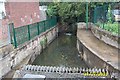

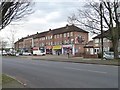


![Housing on the Brackenhill site [1] in HA2 8SH](https://images.propbar.co.uk/images/geograph/48/60/4860770_120.jpg)
Area Information
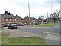
HA2 8SH is a small, tightly knit residential postcode in England, home to 1,643 people. This area is characterised by its compact cluster of homes, offering a quiet, community-focused environment. The population reflects a mature demographic, with a median age of 47 and a strong presence of adults aged 30–64. Daily life here is shaped by proximity to essential services, including multiple retail outlets and transport links. The area’s small size means residents often know their neighbours, fostering a sense of familiarity. While it lacks the density of larger urban centres, HA2 8SH provides easy access to nearby towns and amenities. The presence of rail and metro stations, such as Northolt Park and Rayners Lane, ensures connectivity to London’s broader network. For those seeking a balance between tranquillity and accessibility, this postcode offers a practical base with minimal environmental risks and a low crime score. Its blend of stability and convenience makes it a compelling choice for homebuyers prioritising safety and practicality.
- Area Type
- Postcode
- Area Size
- Not available
- Population
- 1643
- Population Density
- 8661 people/km²
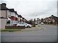
HA2 8SH is a largely owner-occupied area, with 71% of residents living in homes they own. The accommodation type is predominantly houses, which contrasts with areas where flats or apartments dominate. This suggests a market skewed towards family homes and long-term residency rather than short-term rentals. The small size of the postcode means the housing stock is limited, potentially making it a competitive area for buyers. The high home ownership rate indicates a stable market with fewer vacant properties, which can be advantageous for those seeking security in their investment. For prospective buyers, the focus on houses may appeal to those prioritising space and privacy. However, the limited number of properties also means that buyers may need to look beyond the immediate postcode to find options, particularly if they require specific features or larger homes. The absence of significant planning constraints further supports the idea that the area is well-suited for those seeking a settled, low-risk property purchase.
House Prices in HA2 8SH
No properties found in this postcode.
Energy Efficiency in HA2 8SH
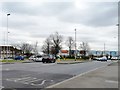
Living in HA2 8SH offers access to a range of amenities within walking or short driving distance. Retail options include major supermarkets such as Tesco Ruislip Field, Tesco Harrow, and Lidl South, ensuring residents have easy access to groceries and daily essentials. The area’s proximity to rail and metro stations, including Northolt Park, South Ruislip, and Rayners Lane, facilitates quick travel to nearby towns and London. While the postcode itself is small, its connections to surrounding areas mean residents can enjoy a broader selection of leisure and cultural activities. The presence of RAF Northolt, though primarily a military base, does not detract from the residential character of the area. The combination of local shops, transport links, and low environmental risks creates a lifestyle that balances convenience with a sense of community, ideal for those seeking a stable, accessible home.
Amenities
Schools
| Rank | School | Type | Entry gender | Ages |
|---|
Explore more schools in this area
Go to Schools tabDemographics
The community in HA2 8SH is predominantly composed of adults aged 30–64, with a median age of 47. This suggests a population that is largely established in careers and family life. Home ownership is high, with 71% of residents owning their homes, indicating a stable and long-term demographic. The area is primarily composed of houses rather than flats, reflecting a preference for traditional family homes. The predominant ethnic group is Asian_total, which shapes the cultural fabric of the neighbourhood. While specific data on deprivation is not provided, the high home ownership rate and low crime score suggest a generally secure and self-sufficient community. The absence of significant planning constraints, such as protected woodlands or AONB designations, means residents face fewer restrictions on development or land use. This combination of factors creates an environment where families and professionals can thrive without the pressures of high turnover or regulatory hurdles.
Household Size
Accommodation Type
Tenure
Ethnic Group
Religion
Household Composition
Age
Household Deprivation
NS-SEC
Explore more demographic insights in this area
Go to Demographics tabPlanning
Planning Constraints
- Flood RiskPremium
- Ramsar Wetland SitesPremium
- Area of Outstanding Natural BeautyPremium
- Protected Nature ReservePremium
- Protected WoodlandPremium
- Crime RiskPremium