Area Overview for HA2 8RU
Photos of HA2 8RU


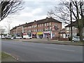


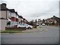
![Housing on the Brackenhill site [1] in HA2 8RU](https://images.propbar.co.uk/images/geograph/48/60/4860770_120.jpg)
53 photos from this area
Area Information
Key information about the HA2 8RU including its size, population, and administrative classification.
- Area Type
- Postcode
- Area Size
- 9854 m²
- Population
- 1736
- Population Density
- 10111 people/km²
House Prices in HA2 8RU
35
Properties
£242,217
Average Sold Price
£20,000
Lowest Price
£621,000
Highest Price
Showing 35 properties
| Address | Type | Beds | Baths | Last Sale Price | Last Sale Date | |
|---|---|---|---|---|---|---|
| 293 Eastcote Lane, Harrow, HA2 8RU | Terraced | 2 | 1 | £400,000 | Jul 2024 | |
| 313 Eastcote Lane, Harrow, HA2 8RU | Semi-detached | 2 | 1 | £621,000 | Apr 2023 | |
| 307 Eastcote Lane, Harrow, HA2 8RU | house | - | - | £400,000 | Sep 2019 | |
| 315 Eastcote Lane, Harrow, HA2 8RU | Maisonette | 2 | 1 | £39,000 | Jun 2019 | |
| 319 Eastcote Lane, Harrow, HA2 8RU | Flat | - | - | £20,000 | Jun 2019 | |
| 323 Eastcote Lane, Harrow, HA2 8RU | Flat | - | - | £65,000 | Jun 2019 | |
| 321 Eastcote Lane, Harrow, HA2 8RU | Maisonette | 1 | 1 | £290,000 | Jun 2018 | |
| 271 Eastcote Lane, Harrow, HA2 8RU | Terraced | 2 | 1 | £325,000 | Jun 2015 | |
| 259 Eastcote Lane, Harrow, HA2 8RU | Terraced | 6 | 2 | £441,000 | Dec 2014 | |
| 297 Eastcote Lane, Harrow, HA2 8RU | Terraced | 2 | 2 | £290,000 | Jun 2014 |
Page 1 of 4
Energy Efficiency in HA2 8RU
Amenities
Schools
| Rank | School | Type | Entry gender | Ages |
|---|
Explore more schools in this area
Go to Schools tabDemographics
Household Size
Family (3-5 people)
most common
Accommodation Type
Houses
most common
Tenure
37
majority
Ethnic Group
White
most common
Religion
N/A
most common
Household Composition
N/A
most common
Age
47
median
Adults (30-64 years)
most common
Household Deprivation
N/A
with no deprivation
NS-SEC
23
in Lower managerial occupations
Explore more demographic insights in this area
Go to Demographics tabPlanning
Planning Constraints
- Flood RiskPremium
- Ramsar Wetland SitesPremium
- Area of Outstanding Natural BeautyPremium
- Protected Nature ReservePremium
- Protected WoodlandPremium