Area Overview for HA2 8EJ
Photos of HA2 8EJ


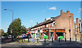

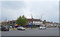
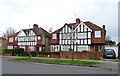
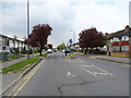
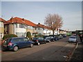
47 photos from this area
Area Information
Key information about the HA2 8EJ including its size, population, and administrative classification.
- Area Type
- Postcode
- Area Size
- 1.0 hectares
- Population
- 1817
- Population Density
- 5565 people/km²
House Prices in HA2 8EJ
27
Properties
£537,778
Average Sold Price
£175,000
Lowest Price
£730,000
Highest Price
Showing 27 properties
| Address | Type | Beds | Baths | Last Sale Price | Last Sale Date | |
|---|---|---|---|---|---|---|
| 60 Corbins Lane, South Harrow, HA2 8EJ | Detached | 4 | 2 | £615,000 | Aug 2024 | |
| 50 Corbins Lane, South Harrow, HA2 8EJ | house | - | - | £700,000 | Jun 2022 | |
| 64 Corbins Lane, South Harrow, HA2 8EJ | Detached | 7 | 3 | £637,500 | Nov 2021 | |
| 58 Corbins Lane, South Harrow, HA2 8EJ | house | - | - | £685,000 | Nov 2021 | |
| 62 Corbins Lane, South Harrow, HA2 8EJ | Flat | - | - | £637,500 | Nov 2021 | |
| 70 Corbins Lane, South Harrow, HA2 8EJ | Detached | 5 | 2 | £730,000 | Aug 2017 | |
| 66 Corbins Lane, South Harrow, HA2 8EJ | Detached | 3 | 1 | £475,000 | Jul 2016 | |
| 74 Corbins Lane, South Harrow, HA2 8EJ | house | - | - | £175,000 | Mar 1999 | |
| 48 Corbins Lane, South Harrow, HA2 8EJ | Detached | - | - | £185,000 | Dec 1998 | |
| 86 Corbins Lane, South Harrow, HA2 8EJ | Flat | 2 | 1 | - | - |
Page 1 of 3
Energy Efficiency in HA2 8EJ
Amenities
Schools
| Rank | School | Type | Entry gender | Ages |
|---|
Explore more schools in this area
Go to Schools tabDemographics
Household Size
Family (3-5 people)
most common
Accommodation Type
Houses
most common
Tenure
61
majority
Ethnic Group
asian_total
most common
Religion
N/A
most common
Household Composition
N/A
most common
Age
47
median
Adults (30-64 years)
most common
Household Deprivation
N/A
with no deprivation
NS-SEC
32
in Lower managerial occupations
Explore more demographic insights in this area
Go to Demographics tabPlanning
Planning Constraints
- Flood RiskPremium
- Ramsar Wetland SitesPremium
- Area of Outstanding Natural BeautyPremium
- Protected Nature ReservePremium
- Protected WoodlandPremium