Area Overview for HA2 8BW
Photos of HA2 8BW


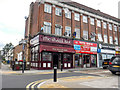

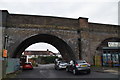
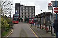

91 photos from this area
Area Information
Key information about the HA2 8BW including its size, population, and administrative classification.
- Area Type
- Postcode
- Area Size
- 3470 m²
- Population
- 1930
- Population Density
- 6585 people/km²
House Prices in HA2 8BW
21
Properties
£261,000
Average Sold Price
£80,000
Lowest Price
£475,000
Highest Price
Showing 21 properties
| Address | Type | Beds | Baths | Last Sale Price | Last Sale Date | |
|---|---|---|---|---|---|---|
| 17 Eastcote Lane, Harrow, HA2 8BW | Semi-detached | 3 | 1 | £475,000 | Nov 2019 | |
| 15A Eastcote Lane, Harrow, HA2 8BW | Maisonette | 2 | - | £275,500 | May 2018 | |
| 5 Eastcote Lane, Harrow, HA2 8BW | Flat | 3 | - | £275,000 | Dec 2009 | |
| 7 Eastcote Lane, Harrow, HA2 8BW | house | - | - | £273,000 | Sep 2009 | |
| 11 Eastcote Lane, Harrow, HA2 8BW | Terraced | - | - | £187,500 | Jan 2003 | |
| 9 Eastcote Lane, Harrow, HA2 8BW | Terraced | - | - | £80,000 | Aug 1995 | |
| 15 Eastcote Lane, Harrow, HA2 8BW | Maisonette | 2 | 1 | - | - | |
| Flat 1, 19 Eastcote Lane, Harrow, HA2 8BW | Flat | 1 | 1 | - | - | |
| H. Carolan Construction Ltd, 1 Eastcote Lane, Harrow, HA2 8BW | office_workshop | - | - | - | - | |
| Flat 1, 5 Eastcote Lane, Harrow, HA2 8BW | Flat | 1 | 1 | - | - |
Page 1 of 3
Energy Efficiency in HA2 8BW
Amenities
Schools
| Rank | School | Type | Entry gender | Ages |
|---|
Explore more schools in this area
Go to Schools tabDemographics
Household Size
Family (3-5 people)
most common
Accommodation Type
Houses
most common
Tenure
43
majority
Ethnic Group
asian_total
most common
Religion
N/A
most common
Household Composition
N/A
most common
Age
47
median
Adults (30-64 years)
most common
Household Deprivation
N/A
with no deprivation
NS-SEC
22
in Lower managerial occupations
Explore more demographic insights in this area
Go to Demographics tabPlanning
Planning Constraints
- Flood RiskPremium
- Ramsar Wetland SitesPremium
- Area of Outstanding Natural BeautyPremium
- Protected Nature ReservePremium
- Protected WoodlandPremium