Area Overview for HA2 8AW
Photos of HA2 8AW

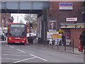

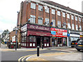

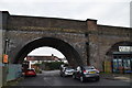
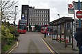

91 photos from this area
Area Information
Key information about the HA2 8AW including its size, population, and administrative classification.
- Area Type
- Postcode
- Area Size
- 1.1 hectares
- Population
- 1971
- Population Density
- 15831 people/km²
House Prices in HA2 8AW
36
Properties
£286,906
Average Sold Price
£70,000
Lowest Price
£491,000
Highest Price
Showing 36 properties
| Address | Type | Beds | Baths | Last Sale Price | Last Sale Date | |
|---|---|---|---|---|---|---|
| 5 Sherwood Road, South Harrow, HA2 8AW | Terraced | 3 | 1 | £458,000 | Jul 2024 | |
| 7 Sherwood Road, South Harrow, HA2 8AW | Terraced | 3 | 1 | £470,000 | Mar 2023 | |
| 9 Sherwood Road, South Harrow, HA2 8AW | Terraced | 3 | 1 | £491,000 | Nov 2022 | |
| 41 Sherwood Road, South Harrow, HA2 8AW | Flat | 1 | 1 | £230,000 | Feb 2021 | |
| 55 Sherwood Road, South Harrow, HA2 8AW | Flat | - | - | £230,000 | Jul 2020 | |
| 31 Sherwood Road, South Harrow, HA2 8AW | Terraced | 3 | 1 | £415,000 | Jan 2019 | |
| 45 Sherwood Road, South Harrow, HA2 8AW | Terraced | 3 | 1 | £433,000 | Dec 2018 | |
| 53 Sherwood Road, South Harrow, HA2 8AW | Terraced | 3 | 1 | £399,950 | Sep 2018 | |
| 23 Sherwood Road, South Harrow, HA2 8AW | Semi-detached | 3 | 1 | £424,950 | Aug 2015 | |
| 35 Sherwood Road, South Harrow, HA2 8AW | house | 2 | - | £249,950 | Aug 2012 |
Page 1 of 4
Energy Efficiency in HA2 8AW
Amenities
Schools
| Rank | School | Type | Entry gender | Ages |
|---|
Explore more schools in this area
Go to Schools tabDemographics
Household Size
Family (3-5 people)
most common
Accommodation Type
Flats
most common
Tenure
38
majority
Ethnic Group
asian_total
most common
Religion
N/A
most common
Household Composition
N/A
most common
Age
47
median
Adults (30-64 years)
most common
Household Deprivation
N/A
with no deprivation
NS-SEC
32
in Lower managerial occupations
Explore more demographic insights in this area
Go to Demographics tabPlanning
Planning Constraints
- Flood RiskPremium
- Ramsar Wetland SitesPremium
- Area of Outstanding Natural BeautyPremium
- Protected Nature ReservePremium
- Protected WoodlandPremium