Area Overview for HA2 7RF
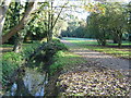
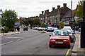
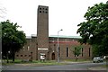
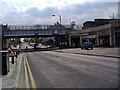
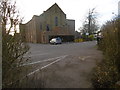
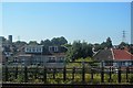
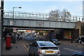
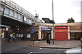
Photos of HA2 7RF
Area Information
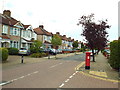
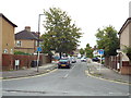
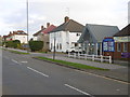
HA2 7RF is a small residential postcode area in England, home to 1880 residents. Its compact size means it offers a quiet, close-knit environment, though it remains well-connected to nearby urban centres. The area is characterised by a predominance of houses, reflecting a stable, family-oriented community. With a median age of 47, the population skews towards adults aged 30–64, suggesting a mix of established residents and families. The area’s proximity to multiple transport hubs, including metro and rail stations, ensures easy access to London and surrounding towns. For those prioritising safety, the low crime risk score of 90/100 and minimal environmental hazards make it an attractive choice. Daily life here balances suburban tranquillity with practical amenities, from retail outlets to schools. Living in HA2 7RF means enjoying a blend of residential comfort and accessibility, ideal for those seeking a manageable lifestyle without sacrificing convenience.
- Area Type
- Postcode
- Area Size
- Not available
- Population
- 1880
- Population Density
- 6454 people/km²
The property market in HA2 7RF is dominated by owner-occupied homes, with 78% of properties owned by residents rather than rented. This high ownership rate points to a community of long-term residents and a stable market with limited turnover. The predominance of houses over flats or apartments suggests a focus on family-friendly, spacious living. Given the area’s small size, the housing stock is likely limited, making it a niche market for buyers seeking a specific postcode. The lack of rental properties may indicate a lower demand for short-term lets, possibly due to the area’s residential character. For buyers, this means a focus on purchasing rather than renting, with properties likely retaining value due to their scarcity. The mix of houses and the area’s safety profile make it appealing to families and professionals prioritising security and permanence.
House Prices in HA2 7RF
No properties found in this postcode.
Energy Efficiency in HA2 7RF
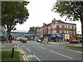
Residents of HA2 7RF enjoy a range of amenities within practical reach. The area’s retail offerings include five major stores, such as Tesco Harrow and Sainsburys Rayners, ensuring easy access to groceries and daily essentials. Five metro stations, including North Harrow and Rayners Lane, provide quick connections to London and beyond, while five rail stations offer additional commuting options. The nearby RAF Northolt, though not a civilian hub, adds to the area’s strategic positioning. For leisure, the compact residential cluster is complemented by schools and green spaces, though specific parks are not named in the data. The combination of retail, transport, and educational facilities creates a convenient lifestyle, allowing residents to balance work, family, and personal needs without long commutes. The area’s small size ensures that amenities are never far, enhancing the overall quality of life.
Amenities
Schools
Residents of HA2 7RF have access to two primary schools: Longfield Primary School, which holds an Ofsted rating of ‘good’, and Longfield Infant School and Nursery. These institutions cater to younger children, providing a seamless transition from nursery to primary education. The presence of both infant and primary schools within the area ensures that families do not need to travel far for their children’s education. The ‘good’ rating at Longfield Primary School suggests a satisfactory standard of teaching and facilities, though no further details on curriculum or performance are available. For parents, this combination of schools offers flexibility, particularly for households with multiple children at different stages of education. The proximity of these schools to homes in HA2 7RF reinforces the area’s appeal to families prioritising educational convenience.
| Rank | School | Type | Entry gender | Ages |
|---|
Explore more schools in this area
Go to Schools tabDemographics
The community in HA2 7RF is predominantly composed of adults aged 30–64, with a median age of 47. This suggests a mature, settled population, likely with strong ties to local institutions and long-term residency. Home ownership rates are high at 78%, indicating a stable housing market and a preference for long-term investment in property. The area is primarily composed of houses, which aligns with the demographic profile of families and individuals seeking permanent, spacious living arrangements. The predominant ethnic group is Asian, reflecting a cultural diversity that shapes local traditions and community dynamics. While no specific data on deprivation is provided, the high home ownership and low crime risk suggest a relatively affluent or stable socioeconomic environment. This combination of factors likely contributes to a cohesive, low-stress living experience for residents.
Household Size
Accommodation Type
Tenure
Ethnic Group
Religion
Household Composition
Age
Household Deprivation
NS-SEC
Explore more demographic insights in this area
Go to Demographics tabPlanning
Planning Constraints
- Flood RiskPremium
- Ramsar Wetland SitesPremium
- Area of Outstanding Natural BeautyPremium
- Protected Nature ReservePremium
- Protected WoodlandPremium