Area Overview for HA2 7RB
Photos of HA2 7RB

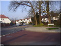
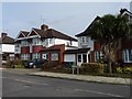
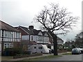
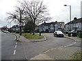
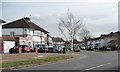
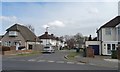
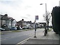


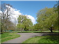
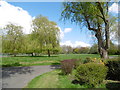
50 photos from this area
Area Information
Key information about the HA2 7RB including its size, population, and administrative classification.
- Area Type
- Postcode
- Area Size
- 3.8 hectares
- Population
- 1407
- Population Density
- 4733 people/km²
House Prices in HA2 7RB
43
Properties
£464,461
Average Sold Price
£104,000
Lowest Price
£895,000
Highest Price
Showing 43 properties
| Address | Type | Beds | Baths | Last Sale Price | Last Sale Date | |
|---|---|---|---|---|---|---|
| 153 Northumberland Road, North Harrow, HA2 7RB | Detached | 4 | 2 | £873,000 | Aug 2025 | |
| 113 Northumberland Road, North Harrow, HA2 7RB | Semi-detached | 5 | 2 | £750,000 | Sep 2024 | |
| 119 Northumberland Road, North Harrow, HA2 7RB | Semi-detached | 3 | 1 | £700,000 | Dec 2023 | |
| 157 Northumberland Road, North Harrow, HA2 7RB | Semi-detached | 5 | 2 | £895,000 | Jul 2023 | |
| 123 Northumberland Road, North Harrow, HA2 7RB | Semi-detached | 3 | 2 | £693,000 | Jul 2022 | |
| 175 Northumberland Road, North Harrow, HA2 7RB | Detached | 4 | 1 | £692,500 | Jan 2021 | |
| 183 Northumberland Road, North Harrow, HA2 7RB | Detached | 3 | 2 | £760,000 | Sep 2019 | |
| 109 Northumberland Road, North Harrow, HA2 7RB | Detached | 3 | 1 | £552,000 | Jun 2018 | |
| 163 Northumberland Road, North Harrow, HA2 7RB | Detached | 3 | 1 | £585,000 | Feb 2017 | |
| 141 Northumberland Road, North Harrow, HA2 7RB | Semi-detached | 4 | 1 | £705,000 | Jun 2016 |
Page 1 of 5
Energy Efficiency in HA2 7RB
Amenities
Schools
| Rank | School | Type | Entry gender | Ages |
|---|
Explore more schools in this area
Go to Schools tabDemographics
Household Size
Family (3-5 people)
most common
Accommodation Type
Houses
most common
Tenure
89
majority
Ethnic Group
asian_total
most common
Religion
N/A
most common
Household Composition
N/A
most common
Age
47
median
Adults (30-64 years)
most common
Household Deprivation
N/A
with no deprivation
NS-SEC
49
in Lower managerial occupations
Explore more demographic insights in this area
Go to Demographics tabPlanning
Planning Constraints
- Flood RiskPremium
- Ramsar Wetland SitesPremium
- Area of Outstanding Natural BeautyPremium
- Protected Nature ReservePremium
- Protected WoodlandPremium