Area Overview for HA2 6ED
Photos of HA2 6ED
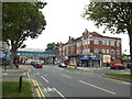
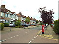
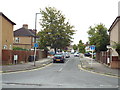
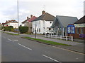
68 photos from this area
Area Information
Key information about the HA2 6ED including its size, population, and administrative classification.
- Area Type
- Postcode
- Area Size
- 7737 m²
- Population
- 1698
- Population Density
- 6447 people/km²
House Prices in HA2 6ED
28
Properties
£340,400
Average Sold Price
£200,000
Lowest Price
£655,000
Highest Price
Showing 28 properties
| Address | Type | Beds | Baths | Last Sale Price | Last Sale Date | |
|---|---|---|---|---|---|---|
| 13B, Broadwalk, Pinner Road, North Harrow, HA2 6ED | Flat | - | - | £300,000 | Oct 2024 | |
| 28A, Broadwalk, Pinner Road, North Harrow, HA2 6ED | Flat | - | - | £247,000 | Jun 2021 | |
| 20A, Broadwalk, Pinner Road, North Harrow, HA2 6ED | Flat | - | - | £300,000 | Sep 2019 | |
| 25A, Broadwalk, Pinner Road, North Harrow, HA2 6ED | Flat | - | - | £655,000 | Jun 2008 | |
| 15B, Broadwalk, Pinner Road, North Harrow, HA2 6ED | Flat | - | - | £200,000 | Feb 2001 | |
| 21B, Broadwalk, Pinner Road, North Harrow, HA2 6ED | Retail | - | - | - | - | |
| 23A, Broadwalk, Pinner Road, North Harrow, HA2 6ED | Retail | - | - | - | - | |
| 22A, Broadwalk, Pinner Road, North Harrow, HA2 6ED | Flat | - | - | - | - | |
| 18A, Broadwalk, Pinner Road, North Harrow, HA2 6ED | Flat | - | - | - | - | |
| 13A, Broadwalk, Pinner Road, North Harrow, HA2 6ED | Flat | - | - | - | - |
Page 1 of 3
Energy Efficiency in HA2 6ED
Amenities
Schools
| Rank | School | Type | Entry gender | Ages |
|---|
Explore more schools in this area
Go to Schools tabDemographics
Household Size
Family (3-5 people)
most common
Accommodation Type
Houses
most common
Tenure
65
majority
Ethnic Group
asian_total
most common
Religion
N/A
most common
Household Composition
N/A
most common
Age
47
median
Adults (30-64 years)
most common
Household Deprivation
N/A
with no deprivation
NS-SEC
40
in Lower managerial occupations
Explore more demographic insights in this area
Go to Demographics tabPlanning
Planning Constraints
- Flood RiskPremium
- Ramsar Wetland SitesPremium
- Area of Outstanding Natural BeautyPremium
- Protected Nature ReservePremium
- Protected WoodlandPremium