Area Overview for HA2 6EA
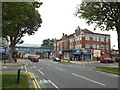
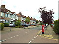
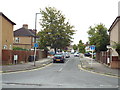
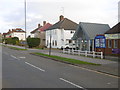
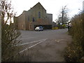
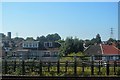
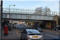
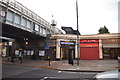
Photos of HA2 6EA


Area Information
HA2 6EA is a small, tightly knit residential postcode in England, home to 1,698 people. It is a compact area where daily life revolves around local amenities and community connections. The population suggests a modest, stable community, with no indication of rapid growth or decline. As a residential cluster, it offers a quiet, focused living environment, distinct from larger urban centres. The area’s character is shaped by its proximity to transport hubs and retail options, making it accessible for commuters while retaining a sense of local identity. With a median age of 47 and a majority of residents aged 30–64, the area is neither dominated by young families nor elderly retirees, but rather a balanced mix of working-age adults. This demographic profile hints at a community with established careers and long-term residency, contributing to a familiar, steady rhythm of life. The presence of multiple retail outlets and transport links within practical reach further underscores HA2 6EA’s practicality for those seeking convenience without the chaos of a dense city.
- Area Type
- Postcode
- Area Size
- Not available
- Population
- 1698
- Population Density
- 6447 people/km²
The property market in HA2 6EA is characterised by a high rate of home ownership (65%) and a predominance of houses. This suggests a market skewed towards owner-occupied properties rather than rental units, which may reflect the area’s appeal to long-term residents. The focus on houses, rather than flats or apartments, indicates a preference for larger, more private living spaces, which could be a draw for families or individuals seeking space. However, the small size of the postcode area means the housing stock is limited, potentially leading to competition among buyers. For those considering the area, the high home ownership rate implies a stable market, but the limited number of properties may mean fewer options for buyers. The presence of nearby transport links, such as Rayners Lane Station, could also influence property values, as accessibility to major routes is a key factor in desirability.
House Prices in HA2 6EA
No properties found in this postcode.
Energy Efficiency in HA2 6EA
Living in HA2 6EA offers access to a range of practical amenities within reach. The area is served by five retail outlets, including Tesco Harrow and Sainsburys Rayners, providing everyday shopping convenience. Transport links are robust, with five metro stations and five rail stations nearby, including North Harrow and Rayners Lane, which connect residents to major routes and London. These stations facilitate easy commuting and access to broader services. While the area lacks major leisure or entertainment venues, the presence of RAF Northolt nearby may cater to niche interests. The retail and transport options suggest a lifestyle focused on functionality, with minimal need to travel far for essentials. The compact nature of the postcode means amenities are concentrated, reducing travel time and enhancing convenience for daily tasks.
Amenities
Schools
| Rank | School | Type | Entry gender | Ages |
|---|
Explore more schools in this area
Go to Schools tabDemographics
The community in HA2 6EA is predominantly composed of adults aged 30–64, with a median age of 47. This suggests a mature, established population, likely with strong ties to the area. Home ownership is high at 65%, indicating a stable housing market and a preference for long-term residency over renting. The accommodation type is primarily houses, which aligns with the area’s residential character and may appeal to those seeking more space than a flat. The predominant ethnic group is Asian, reflecting a cultural diversity that shapes the local identity. While no specific deprivation data is provided, the high home ownership rate and balanced age profile suggest a community with relatively stable economic conditions. The absence of specific data on income or deprivation means this analysis focuses on the known factors: a mix of working-age adults, a focus on owner-occupied homes, and a cultural composition that adds to the area’s distinctiveness.
Household Size
Accommodation Type
Tenure
Ethnic Group
Religion
Household Composition
Age
Household Deprivation
NS-SEC
Explore more demographic insights in this area
Go to Demographics tabPlanning
Planning Constraints
- Flood RiskPremium
- Ramsar Wetland SitesPremium
- Area of Outstanding Natural BeautyPremium
- Protected Nature ReservePremium
- Protected WoodlandPremium