Area Overview for HA2 0UD
Photos of HA2 0UD
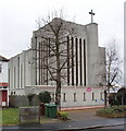


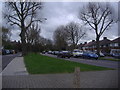
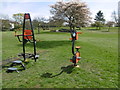
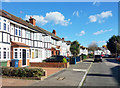
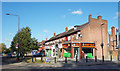

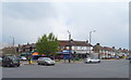
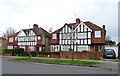
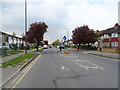
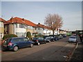
47 photos from this area
Area Information
Key information about the HA2 0UD including its size, population, and administrative classification.
- Area Type
- Postcode
- Area Size
- 7322 m²
- Population
- 1888
- Population Density
- 6871 people/km²
House Prices in HA2 0UD
22
Properties
£297,933
Average Sold Price
£93,950
Lowest Price
£510,000
Highest Price
Showing 22 properties
| Address | Type | Beds | Baths | Last Sale Price | Last Sale Date | |
|---|---|---|---|---|---|---|
| 31 Rayners Lane, Rayners Lane, HA2 0UD | Terraced | 4 | 2 | £500,000 | May 2020 | |
| 3 Rayners Lane, Rayners Lane, HA2 0UD | Semi-detached | 3 | 1 | £200,000 | May 2019 | |
| 19 Rayners Lane, Rayners Lane, HA2 0UD | Flat | 1 | 1 | £329,950 | Sep 2017 | |
| 1 Rayners Lane, Rayners Lane, HA2 0UD | Maisonette | 2 | 1 | £510,000 | Mar 2017 | |
| 35 Rayners Lane, Rayners Lane, HA2 0UD | Terraced | 3 | 1 | £390,000 | Jun 2015 | |
| 29 Rayners Lane, Rayners Lane, HA2 0UD | Terraced | 4 | 2 | £327,500 | Feb 2015 | |
| 23 Rayners Lane, Rayners Lane, HA2 0UD | house | - | - | £210,000 | Mar 2012 | |
| 33 Rayners Lane, Rayners Lane, HA2 0UD | Terraced | 3 | 1 | £120,000 | Jun 1999 | |
| 7 Rayners Lane, Rayners Lane, HA2 0UD | Semi-detached | - | - | £93,950 | May 1997 | |
| Flat A, 11 Rayners Lane, Rayners Lane, HA2 0UD | Maisonette | 2 | 1 | - | - |
Page 1 of 3
Energy Efficiency in HA2 0UD
Amenities
Schools
| Rank | School | Type | Entry gender | Ages |
|---|
Explore more schools in this area
Go to Schools tabDemographics
Household Size
Family (3-5 people)
most common
Accommodation Type
Flats
most common
Tenure
46
majority
Ethnic Group
asian_total
most common
Religion
N/A
most common
Household Composition
N/A
most common
Age
47
median
Adults (30-64 years)
most common
Household Deprivation
N/A
with no deprivation
NS-SEC
27
in Lower managerial occupations
Explore more demographic insights in this area
Go to Demographics tabPlanning
Planning Constraints
- Flood RiskPremium
- Ramsar Wetland SitesPremium
- Area of Outstanding Natural BeautyPremium
- Protected Nature ReservePremium
- Protected WoodlandPremium