Area Overview for HA2 0QW
Photos of HA2 0QW
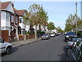
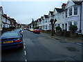
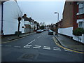
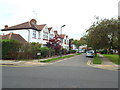
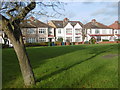
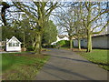
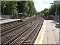
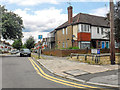
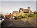
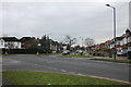
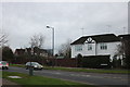
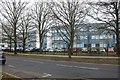
61 photos from this area
Area Information
Key information about the HA2 0QW including its size, population, and administrative classification.
- Area Type
- Postcode
- Area Size
- 4461 m²
- Population
- 1610
- Population Density
- 10960 people/km²
House Prices in HA2 0QW
16
Properties
£352,119
Average Sold Price
£88,000
Lowest Price
£561,000
Highest Price
Showing 16 properties
| Address | Type | Beds | Baths | Last Sale Price | Last Sale Date | |
|---|---|---|---|---|---|---|
| 184 Roxeth Green Avenue, South Harrow, HA2 0QW | Terraced | 3 | 1 | £525,000 | Sep 2025 | |
| 164 Roxeth Green Avenue, South Harrow, HA2 0QW | Terraced | 4 | 2 | £561,000 | Jul 2023 | |
| 180 Roxeth Green Avenue, South Harrow, HA2 0QW | Terraced | 3 | 1 | £490,000 | Feb 2023 | |
| 162 Roxeth Green Avenue, South Harrow, HA2 0QW | Retail | 3 | 1 | £558,000 | Nov 2022 | |
| 188 Roxeth Green Avenue, South Harrow, HA2 0QW | Terraced | 3 | 1 | £235,000 | Mar 2011 | |
| 166 Roxeth Green Avenue, South Harrow, HA2 0QW | house | - | - | £249,950 | Aug 2005 | |
| 176 Roxeth Green Avenue, South Harrow, HA2 0QW | Terraced | - | - | £110,000 | Jul 2002 | |
| 190A Roxeth Green Avenue, South Harrow, HA2 0QW | Terraced | - | - | £88,000 | Sep 1996 | |
| 186 Roxeth Green Avenue, South Harrow, HA2 0QW | Terraced | 3 | 4 | - | - | |
| 174 Roxeth Green Avenue, South Harrow, HA2 0QW | Terraced | - | - | - | - |
Page 1 of 2
Energy Efficiency in HA2 0QW
Amenities
Schools
| Rank | School | Type | Entry gender | Ages |
|---|
Explore more schools in this area
Go to Schools tabDemographics
Household Size
Family (3-5 people)
most common
Accommodation Type
Houses
most common
Tenure
63
majority
Ethnic Group
asian_total
most common
Religion
N/A
most common
Household Composition
N/A
most common
Age
47
median
Adults (30-64 years)
most common
Household Deprivation
N/A
with no deprivation
NS-SEC
31
in Lower managerial occupations
Explore more demographic insights in this area
Go to Demographics tabPlanning
Planning Constraints
- Flood RiskPremium
- Ramsar Wetland SitesPremium
- Area of Outstanding Natural BeautyPremium
- Protected Nature ReservePremium
- Protected WoodlandPremium