Area Overview for HA1 4UG
Photos of HA1 4UG
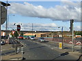
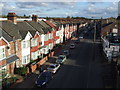
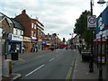
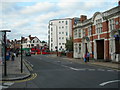
81 photos from this area
Area Information
Key information about the HA1 4UG including its size, population, and administrative classification.
- Area Type
- Postcode
- Area Size
- 3507 m²
- Population
- 2632
- Population Density
- 10346 people/km²
House Prices in HA1 4UG
30
Properties
£161,950
Average Sold Price
£65,000
Lowest Price
£230,000
Highest Price
Showing 30 properties
| Address | Type | Beds | Baths | Last Sale Price | Last Sale Date | |
|---|---|---|---|---|---|---|
| 26, Hereford Court, Danes Gate, Harrow, HA1 4UG | Flat | 3 | 1 | £230,000 | Apr 2025 | |
| 15, Hereford Court, Danes Gate, Harrow, HA1 4UG | Flat | - | - | £185,000 | Jun 2015 | |
| 20, Hereford Court, Danes Gate, Harrow, HA1 4UG | Flat | 3 | 1 | £185,600 | Oct 2014 | |
| 23, Hereford Court, Danes Gate, Harrow, HA1 4UG | Flat | 2 | 1 | £165,000 | Jul 2008 | |
| 14, Hereford Court, Danes Gate, Harrow, HA1 4UG | Flat | - | - | £170,000 | Mar 2006 | |
| 6, Hereford Court, Danes Gate, Harrow, HA1 4UG | Flat | 2 | 1 | £152,000 | Feb 2006 | |
| 13, Hereford Court, Danes Gate, Harrow, HA1 4UG | Flat | - | - | £143,000 | Mar 2003 | |
| 22, Hereford Court, Danes Gate, Harrow, HA1 4UG | Flat | 2 | 1 | £65,000 | Oct 1998 | |
| 3, Hereford Court, Danes Gate, Harrow, HA1 4UG | Maisonette | 2 | 1 | - | - | |
| 25, Hereford Court, Danes Gate, Harrow, HA1 4UG | Flat | - | - | - | - |
Page 1 of 3
Energy Efficiency in HA1 4UG
Amenities
Schools
| Rank | School | Type | Entry gender | Ages |
|---|
Explore more schools in this area
Go to Schools tabDemographics
Household Size
Family (3-5 people)
most common
Accommodation Type
Flats
most common
Tenure
45
majority
Ethnic Group
asian_total
most common
Religion
N/A
most common
Household Composition
N/A
most common
Age
47
median
Adults (30-64 years)
most common
Household Deprivation
N/A
with no deprivation
NS-SEC
29
in Lower managerial occupations
Explore more demographic insights in this area
Go to Demographics tabPlanning
Planning Constraints
- Flood RiskPremium
- Ramsar Wetland SitesPremium
- Area of Outstanding Natural BeautyPremium
- Protected Nature ReservePremium
- Protected WoodlandPremium