Area Overview for HA1 4HT
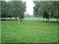
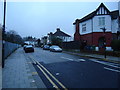
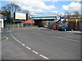
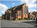
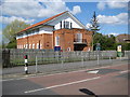
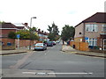
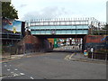
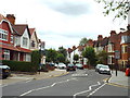
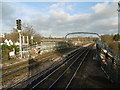
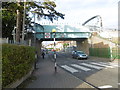
Photos of HA1 4HT
Area Information
HA1 4HT is a small residential postcode in England, home to around 2,475 people. It forms a compact cluster of properties, typical of areas where housing is concentrated around local amenities and transport links. The area’s character is defined by its proximity to retail hubs, public transport, and educational institutions. Daily life here is shaped by a mix of practicality and accessibility, with residents able to reach major services within short distances. The presence of independent schools like Khalsa College London adds to the area’s appeal for families, while the surrounding transport network ensures connectivity to nearby towns and cities. Though small, HA1 4HT offers a balance of residential comfort and urban convenience, with a population that skews toward middle-aged adults. The area’s modest size means community interactions are likely to be more personal, though the lack of large-scale amenities suggests a focus on local, everyday needs over expansive leisure options. For buyers, this postcode represents a niche market where proximity to essential services outweighs the need for sprawling estates or sprawling landscapes.
- Area Type
- Postcode
- Area Size
- Not available
- Population
- 2475
- Population Density
- 8179 people/km²
The property market in HA1 4HT is characterised by a high proportion of rented flats, with home ownership at 42%. This suggests that the area is more of a rental market than an owner-occupied one, likely catering to transient populations such as students or commuters. The prevalence of flats indicates limited availability of larger homes, which may be due to the area’s small size and historical development patterns. For buyers, this means that opportunities for purchasing property are constrained, with most options being smaller, purpose-built apartments. The low home ownership rate also implies that the area may not be ideal for long-term investment, as it lacks the stability of a strong buyer market. However, the proximity to transport links and amenities could make it attractive to those seeking affordable housing near essential services, despite the challenges of limited property diversity.
House Prices in HA1 4HT
Showing 68 properties
Energy Efficiency in HA1 4HT
Residents of HA1 4HT have access to a range of nearby amenities, including five retail outlets such as Morrisons Harrow, M&S Bessborough BP, and Tesco Harrow. These provide essential shopping and dining options, though the selection is limited to major chains rather than independent retailers. The area’s transport links also grant access to broader leisure opportunities beyond its immediate vicinity. While no parks or recreational spaces are explicitly named in the data, the proximity to stations suggests that larger green spaces or cultural venues in nearby towns are within practical reach. The lifestyle here is pragmatic, focused on convenience and accessibility rather than luxury or exclusivity. The availability of retail and transport infrastructure ensures that daily needs are met efficiently, though the lack of detailed information on leisure facilities means that the area’s character beyond basic amenities remains unclear.
Amenities
Schools
The nearest school to HA1 4HT is Khalsa College London, an independent institution. While no Ofsted rating is provided, the presence of an independent school suggests that the area may cater to families seeking private education options. However, the lack of other schools in the data means that the educational landscape is not fully detailed. For families prioritising state education, the absence of listed state schools could be a concern, though the proximity to larger towns may offer alternatives. The single independent school indicates a niche focus on private schooling, which may align with the area’s demographic profile of middle-aged adults and professionals. Buyers should consider whether the availability of a single school type meets their children’s needs, as the data does not confirm the presence of other educational institutions.
| Rank | School | Type | Entry gender | Ages |
|---|
Explore more schools in this area
Go to Schools tabDemographics
The population of HA1 4HT is predominantly adults aged 30–64, with a median age of 47. This suggests a community of established professionals and families, rather than a younger demographic or retirees. Home ownership here is relatively low at 42%, indicating that a significant portion of the housing stock is rented out, possibly to students or workers commuting to nearby employment centres. The majority of properties are flats, which aligns with the area’s compact nature and limited space for larger homes. The predominant ethnic group is Asian_total, reflecting a cultural diversity that influences local traditions and community dynamics. While no specific deprivation data is provided, the mix of rental properties and flats may suggest a population that prioritises affordability over long-term ownership. The absence of detailed socioeconomic breakdowns means that assumptions about quality of life must be made cautiously, but the presence of independent schools and transport links implies a baseline of accessibility and opportunity.
Household Size
Accommodation Type
Tenure
Ethnic Group
Religion
Household Composition
Age
Household Deprivation
NS-SEC
Explore more demographic insights in this area
Go to Demographics tabPlanning
Planning Constraints
- Flood RiskPremium
- Ramsar Wetland SitesPremium
- Area of Outstanding Natural BeautyPremium
- Protected Nature ReservePremium
- Protected WoodlandPremium