Area Overview for HA1 4DA
Photos of HA1 4DA
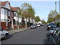
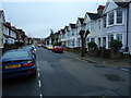
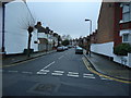
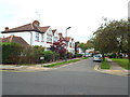
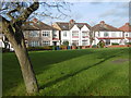
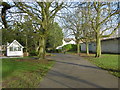
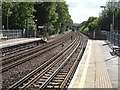
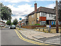
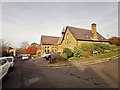
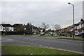
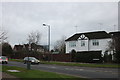

61 photos from this area
Area Information
Key information about the HA1 4DA including its size, population, and administrative classification.
- Area Type
- Postcode
- Area Size
- 7048 m²
- Population
- 1957
- Population Density
- 11621 people/km²
House Prices in HA1 4DA
40
Properties
£364,431
Average Sold Price
£15,000
Lowest Price
£635,000
Highest Price
Showing 40 properties
| Address | Type | Beds | Baths | Last Sale Price | Last Sale Date | |
|---|---|---|---|---|---|---|
| 10 Heath Road, West Harrow, HA1 4DA | Terraced | 3 | 1 | £550,000 | Sep 2024 | |
| 5 Heath Road, West Harrow, HA1 4DA | Terraced | 3 | 1 | £553,000 | Dec 2022 | |
| 25 Heath Road, West Harrow, HA1 4DA | house | 3 | 1 | £540,000 | Oct 2022 | |
| 3 Heath Road, West Harrow, HA1 4DA | Terraced | 3 | 1 | £561,000 | Sep 2022 | |
| 28 Heath Road, West Harrow, HA1 4DA | house | 3 | 2 | £625,000 | May 2022 | |
| 30 Heath Road, West Harrow, HA1 4DA | Terraced | 3 | 1 | £490,000 | Mar 2021 | |
| 20 Heath Road, West Harrow, HA1 4DA | Terraced | 3 | 1 | £510,000 | Mar 2020 | |
| 16 Heath Road, West Harrow, HA1 4DA | Terraced | 3 | 1 | £400,000 | Feb 2019 | |
| 2 HEATH ROAD, West Harrow, HA1 4DA | Flat | 1 | 1 | £330,000 | Jul 2018 | |
| 22 Heath Road, West Harrow, HA1 4DA | Terraced | 4 | 2 | £635,000 | Aug 2017 |
Page 1 of 4
Energy Efficiency in HA1 4DA
Amenities
Schools
| Rank | School | Type | Entry gender | Ages |
|---|
Explore more schools in this area
Go to Schools tabDemographics
Household Size
Family (3-5 people)
most common
Accommodation Type
Houses
most common
Tenure
54
majority
Ethnic Group
White
most common
Religion
N/A
most common
Household Composition
N/A
most common
Age
47
median
Adults (30-64 years)
most common
Household Deprivation
N/A
with no deprivation
NS-SEC
35
in Lower managerial occupations
Explore more demographic insights in this area
Go to Demographics tabPlanning
Planning Constraints
- Flood RiskPremium
- Ramsar Wetland SitesPremium
- Area of Outstanding Natural BeautyPremium
- Protected Nature ReservePremium
- Protected WoodlandPremium