Area Overview for HA1 3UW
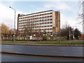
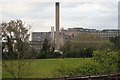
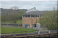
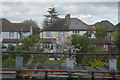
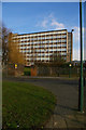
Photos of HA1 3UW


Area Information
HA1 3UW is a small, tightly knit residential postcode in England, home to 2,218 people. The area is characterised by its compact footprint, with a focus on flat living and a community skewed towards adults aged 30–64. This is a place where daily life revolves around practicality, with residents often relying on nearby transport links and local amenities. The postcode’s proximity to Northwick Park Station and multiple rail connections ensures easy access to surrounding towns, while the presence of RAF Northolt adds a unique layer to the area’s profile. Despite its modest size, HA1 3UW offers a blend of convenience and connectivity, though its small scale means the housing stock is limited to flats, with a low home ownership rate. The area’s demographic profile suggests a mature population, with a significant proportion of Asian residents, shaping a community with distinct cultural dynamics. For those seeking a quiet, functional living environment with accessible transport, HA1 3UW presents a specific set of opportunities and considerations.
- Area Type
- Postcode
- Area Size
- Not available
- Population
- 2218
- Population Density
- 2754 people/km²
The property market in HA1 3UW is defined by its low home ownership rate of 30%, suggesting that the majority of residents are renters rather than homeowners. The accommodation type is predominantly flats, which aligns with the area’s compact nature and limited housing stock. This dynamic positions HA1 3UW as a rental-focused area, with limited scope for owner-occupation. For buyers, this means the available housing is constrained to flats, and the small postcode area offers little in the way of alternative property types. The lack of detached homes or larger properties may make it challenging for those seeking family homes or investment opportunities. However, the proximity to transport hubs like Northwick Park Station and the presence of nearby retail amenities could offset the limitations of the housing stock. Buyers should approach the market with realistic expectations, recognising that HA1 3UW is not a traditional buyer’s market but one shaped by rental demand and limited supply.
House Prices in HA1 3UW
No properties found in this postcode.
Energy Efficiency in HA1 3UW
HA1 3UW offers a range of amenities within easy reach, including retail options such as M&S Northwick, Sainsburys Kenton, and Budgens Kenton. These shops provide essential services and everyday conveniences, reducing the need for long trips. The area’s transport links further enhance accessibility, with multiple metro and rail stations enabling swift travel to nearby towns and attractions. The presence of RAF Northolt adds a distinct character to the local landscape, though it does not directly influence daily leisure activities. For residents, the combination of retail, transport, and proximity to larger urban centres creates a functional lifestyle, where practicality outweighs luxury. While the area lacks expansive parks or leisure facilities, the nearby stations and shops ensure a baseline of convenience for everyday living.
Amenities
Schools
The nearest school to HA1 3UW is School Room, categorised as an "other" type, though its Ofsted rating is not specified in the data. This single listed school suggests a limited range of educational options for families in the area. The absence of additional schools in the immediate vicinity means that parents may need to consider commuting to nearby postcodes for a broader selection of primary or secondary schools. The school’s type, while not further detailed, may indicate a specialist or community-focused institution. For families prioritising proximity to educational facilities, HA1 3UW’s school landscape is sparse, requiring careful planning to ensure access to quality schooling. The data does not provide information on the school’s performance or capacity, so further research would be necessary for a comprehensive assessment.
| Rank | School | Type | Entry gender | Ages |
|---|
Explore more schools in this area
Go to Schools tabDemographics
The population of HA1 3UW is 2,218, with a median age of 47, indicating a community predominantly composed of adults aged 30–64. Home ownership is low, at just 30%, suggesting that most residents are either renters or live in shared accommodation. The accommodation type is almost entirely flats, reflecting a housing stock that prioritises density over individual homes. The predominant ethnic group is Asian_total, which shapes the area’s cultural and social landscape. This demographic profile implies a mature, stable population with established ties to the local area. However, the low home ownership rate may indicate a reliance on rental markets or shared living arrangements, which can affect long-term stability. The absence of specific deprivation data means the quality of life is inferred from the available amenities and transport links, though the community’s character is clearly defined by its age profile and ethnic composition.
Household Size
Accommodation Type
Tenure
Ethnic Group
Religion
Household Composition
Age
Household Deprivation
NS-SEC
Explore more demographic insights in this area
Go to Demographics tabPlanning
Planning Constraints
- Flood RiskPremium
- Ramsar Wetland SitesPremium
- Area of Outstanding Natural BeautyPremium
- Protected Nature ReservePremium
- Protected WoodlandPremium