Area Overview for HA1 3TP
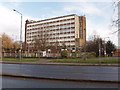
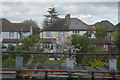
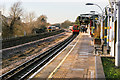
Photos of HA1 3TP


Area Information
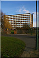
HA1 3TP is a small, densely populated residential area in England, covering just 12.4 hectares. With 2,218 residents packed into this compact space, it’s a tightly knit community where proximity to amenities and transport is key. The area’s high population density of 17,848 people per square kilometre reflects its urban character, shaped by a mix of flats and shared living spaces. Daily life here revolves around nearby transport hubs, including Northwick Park Station and Preston Road Station, which connect residents to London’s broader network. The area’s compact size means most essentials are within walking distance, though its small footprint also means it’s a niche location for those prioritising convenience over space. The demographic profile—primarily adults aged 30–64, with a median age of 47—suggests a stable, mature population. While the area lacks major landmarks, its strategic position near Harrow and Kenton offers access to broader suburban and commercial zones. For those seeking a compact, well-connected home, HA1 3TP offers a blend of practicality and proximity, though its limited size may not suit those needing more open space.
- Area Type
- Postcode
- Area Size
- 12.4 hectares
- Population
- 2218
- Population Density
- 2754 people/km²
The property market in HA1 3TP is characterised by a low home ownership rate of 30%, indicating that the majority of residents rent their homes. This suggests a rental market that may be more dynamic than owner-occupied, with landlords and tenants forming the primary housing stock. The accommodation type is predominantly flats, which aligns with the area’s high population density and compact size. This means the housing stock is largely composed of smaller, multi-unit buildings, often in shared or semi-attached configurations. For buyers, this presents a challenge: the small area’s limited footprint restricts the number of available properties, and the focus on flats may not appeal to those seeking larger, detached homes. However, for those comfortable with urban living and proximity to transport, the market offers a selection of rental and possibly leasehold options. The area’s size also means that property values may be influenced more by location-specific factors, such as proximity to stations, than by broader trends in the housing market.
House Prices in HA1 3TP
Showing 100 properties (first 250)
| Address | Type | Beds | Baths | Last Sale Price | Last Sale Date | |
|---|---|---|---|---|---|---|
| 21E, University Of Westminster, Block G, Watford Road, Harrow, HA1 3TP | studentAccommodation | - | - | - | - | |
| 49E, University Of Westminster, Block E, Watford Road, Harrow, HA1 3TP | studentAccommodation | - | - | - | - | |
| 45B, University Of Westminster, Block G, Watford Road, Harrow, HA1 3TP | studentAccommodation | - | - | - | - | |
| 52E, University Of Westminster, Block E, Watford Road, Harrow, HA1 3TP | studentAccommodation | - | - | - | - | |
| 33C, University Of Westminster, Block H, Watford Road, Harrow, HA1 3TP | studentAccommodation | - | - | - | - | |
| 44D, University Of Westminster, Block F, Watford Road, Harrow, HA1 3TP | studentAccommodation | - | - | - | - | |
| 31D, University Of Westminster, Block H, Watford Road, Harrow, HA1 3TP | studentAccommodation | - | - | - | - | |
| 44E, University Of Westminster, Block F, Watford Road, Harrow, HA1 3TP | studentAccommodation | - | - | - | - | |
| 30B, University Of Westminster, Block H, Watford Road, Harrow, HA1 3TP | studentAccommodation | - | - | - | - | |
| 45C, University Of Westminster, Block G, Watford Road, Harrow, HA1 3TP | studentAccommodation | - | - | - | - |
Energy Efficiency in HA1 3TP
Living in HA1 3TP offers access to a range of nearby amenities, including retail stores such as M&S Northwick, Budgens Kenton, and Sainsburys Kenton. These provide essential shopping and grocery needs within practical reach. The area’s transport links also open up broader leisure and dining options in Harrow and Kenton, though specific venues are not listed in the data. The presence of multiple metro and rail stations, including Northwick Park and Harrow & Wealdstone, ensures residents can easily access larger commercial or cultural hubs. While the area itself is small, its strategic location near transport arteries means daily life can be enriched by the surrounding suburbs. The character of HA1 3TP is defined by its compactness and convenience, making it ideal for those who prioritise accessibility over expansive local facilities.
Amenities
Schools
The only school listed near HA1 3TP is School Room, categorised as ‘other’. No Ofsted rating or further details are provided, so its quality or performance cannot be assessed from the available data. The absence of other schools in the immediate vicinity means families may need to look beyond the area for primary or secondary education options. This could be a consideration for parents prioritising a range of local schools, though the area’s proximity to Harrow and Kenton may offer nearby alternatives. The single school listed does not indicate a diverse educational landscape, which may require additional research for families seeking a variety of school types or specialisms.
| Rank | School | Type | Entry gender | Ages |
|---|
Explore more schools in this area
Go to Schools tabDemographics
The community in HA1 3TP is predominantly composed of adults aged 30–64, with a median age of 47. This suggests a mature, settled population, likely with established careers and families. Home ownership is low, with only 30% of residents owning their homes, indicating a rental-heavy market. The accommodation type is primarily flats, reflecting the area’s density and urban layout. The predominant ethnic group is Asian_total, though no further breakdown of diversity is provided. The high population density of 17,848 people per square kilometre means living spaces are closely packed, which can influence both social dynamics and the availability of private outdoor space. While the data does not specify deprivation levels, the combination of high density, limited home ownership, and a focus on rental properties may suggest a mix of economic profiles, from professionals to those in more transient housing situations. The area’s demographic profile positions it as a place where older adults and middle-aged professionals coexist, with a strong emphasis on shared living and community proximity.
Household Size
Accommodation Type
Tenure
Ethnic Group
Religion
Household Composition
Age
Household Deprivation
NS-SEC
Explore more demographic insights in this area
Go to Demographics tabPlanning
Planning Constraints
- Flood RiskPremium
- Ramsar Wetland SitesPremium
- Area of Outstanding Natural BeautyPremium
- Protected Nature ReservePremium
- Protected WoodlandPremium