Area Overview for HA1 3LJ
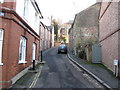
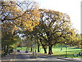
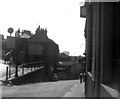
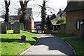
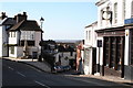
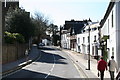
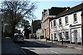
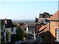
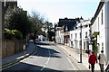
Photos of HA1 3LJ


Area Information
HA1 3LJ is a compact residential postcode in England, covering just 1045 m² and home to 1747 people. Its high population density — 1,671,880 people per square kilometre — reflects a tightly knit community, though the area’s small size means it is more of a cluster of homes than a sprawling suburb. The postcode is characterised by its proximity to key transport links, including multiple rail and metro stations, and major retail hubs like Tesco Harrow and Waitrose South. Daily life here is shaped by its position near London’s western edge, offering a mix of urban convenience and suburban tranquillity. Young adults dominate the demographic, with a median age of 22, suggesting a dynamic, possibly student or young professional-driven population. The area’s limited size means it is best suited for those prioritising accessibility to nearby amenities over expansive living space. For buyers, HA1 3LJ is a niche postcode where proximity to schools, transport, and retail is prioritised over sprawling properties. Its small footprint also means it is more of a stepping stone than a long-term residential area for many.
- Area Type
- Postcode
- Area Size
- 1045 m²
- Population
- 1747
- Population Density
- 2946 people/km²
HA1 3LJ is a small area with a clear focus on owner-occupied housing, with 56% of properties owned by residents rather than rented. The predominant accommodation type is houses, which is unusual for a high-density postcode, suggesting a mix of semi-detached or terraced properties. Given the area’s compact size, the housing stock is likely limited, making it a niche market for buyers seeking proximity to transport and retail rather than expansive properties. The high proportion of owner-occupiers indicates a stable, long-term resident base, though the lack of rental data means it is unclear how much of the market is driven by tenants. For buyers, the small area means competition for properties is likely fierce, with limited scope for expansion. The presence of houses, rather than flats, also suggests a preference for traditional family homes, which may appeal to specific buyer demographics.
House Prices in HA1 3LJ
Showing 1 properties
| Address | Type | Beds | Baths | Last Sale Price | Last Sale Date | |
|---|---|---|---|---|---|---|
| Bradbys, 70 High Street, Harrow Hill, HA1 3LJ | Maisonette | - | - | - | - |
Energy Efficiency in HA1 3LJ
HA1 3LJ offers access to a range of amenities within walking or short driving distance. Retail options include major stores like M&S Bessborough BP, Tesco Harrow, and Waitrose South, providing convenience for daily shopping needs. The area’s transport links also grant easy access to parks, leisure facilities, and other services beyond the immediate postcode. While specific parks or recreational areas are not listed in the data, the presence of multiple rail and metro stations suggests proximity to larger green spaces or public facilities in nearby towns. The mix of retail and transport options indicates a lifestyle focused on accessibility and practicality, though the area’s small size means it is more of a node within a larger network than a standalone hub. For residents, the convenience of nearby amenities is a key advantage, though the lack of detailed information on leisure options may require further local research.
Amenities
Schools
HA1 3LJ is within reach of two prominent independent schools: Harrow School and The John Lyon School. Both are private institutions, offering high-quality education but typically catering to families with significant financial resources. The presence of independent schools in the area suggests that the postcode is attractive to households prioritising elite education, though no state schools are listed in the data. This mix of school types may limit options for families seeking free or affordable education, but it also positions the area as a destination for those investing in private schooling. For buyers, proximity to these schools could be a key selling point, though the lack of state school options may be a drawback for some. The schools’ reputations may also influence property values, with homes near them potentially commanding higher prices.
| Rank | School | Type | Entry gender | Ages |
|---|
Explore more schools in this area
Go to Schools tabDemographics
The population of HA1 3LJ is overwhelmingly young, with a median age of 22 and the majority of residents aged 15–29. This suggests a community shaped by students, early-career professionals, or those in transient employment. Home ownership is relatively high at 56%, with houses being the predominant accommodation type, indicating a mix of family homes and smaller properties. The area’s demographic is largely homogenous, with the White ethnic group making up the majority. While no specific deprivation data is provided, the high population density and young age profile may point to a community with varying economic needs. The absence of significant diversity metrics means the area’s cultural fabric remains less defined, though its proximity to independent schools and transport hubs suggests a focus on education and mobility. For buyers, the age profile and home ownership rate imply a market skewed towards first-time buyers or those seeking short-term residency near key infrastructure.
Household Size
Accommodation Type
Tenure
Ethnic Group
Religion
Household Composition
Age
Household Deprivation
NS-SEC
Explore more demographic insights in this area
Go to Demographics tabPlanning
Planning Constraints
- Flood RiskPremium
- Ramsar Wetland SitesPremium
- Area of Outstanding Natural BeautyPremium
- Protected Nature ReservePremium
- Protected WoodlandPremium