Area Overview for HA1 2NY
Photos of HA1 2NY
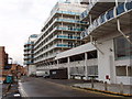

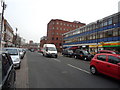


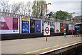
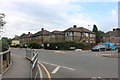


100 photos from this area
Area Information
Key information about the HA1 2NY including its size, population, and administrative classification.
- Area Type
- Postcode
- Area Size
- 1.3 hectares
- Population
- 1407
- Population Density
- 10757 people/km²
House Prices in HA1 2NY
31
Properties
£531,731
Average Sold Price
£295,000
Lowest Price
£1,060,000
Highest Price
Showing 31 properties
| Address | Type | Beds | Baths | Last Sale Price | Last Sale Date | |
|---|---|---|---|---|---|---|
| Flat 1, Excelsior Apartments, 1 Northwick Park Road, Harrow, HA1 2NY | Flat | 2 | 2 | £425,000 | Nov 2025 | |
| 29 Northwick Park Road, Harrow, HA1 2NY | house | 3 | 1 | £685,000 | Jan 2024 | |
| 15 Northwick Park Road, Harrow, HA1 2NY | Detached | 5 | 1 | £1,060,000 | Jan 2023 | |
| 27 Northwick Park Road, Harrow, HA1 2NY | Semi-detached | 4 | - | £745,000 | Jul 2016 | |
| 19 Northwick Park Road, Harrow, HA1 2NY | Detached | 4 | 2 | £885,000 | Jul 2013 | |
| 31 Northwick Park Road, Harrow, HA1 2NY | house | - | - | £422,000 | Mar 2013 | |
| 35 Northwick Park Road, Harrow, HA1 2NY | Semi-detached | - | - | £315,000 | Jun 2005 | |
| 25 Northwick Park Road, Harrow, HA1 2NY | Detached | 5 | 2 | £471,500 | Mar 2004 | |
| 13 Northwick Park Road, Harrow, HA1 2NY | Detached | - | - | £472,000 | Jan 2004 | |
| 11 Northwick Park Road, Harrow, HA1 2NY | Semi-detached | - | - | £489,000 | Aug 2003 |
Page 1 of 4
Energy Efficiency in HA1 2NY
Amenities
Schools
| Rank | School | Type | Entry gender | Ages |
|---|
Explore more schools in this area
Go to Schools tabDemographics
Household Size
Family (3-5 people)
most common
Accommodation Type
Flats
most common
Tenure
37
majority
Ethnic Group
asian_total
most common
Religion
N/A
most common
Household Composition
N/A
most common
Age
47
median
Adults (30-64 years)
most common
Household Deprivation
N/A
with no deprivation
NS-SEC
39
in Lower managerial occupations
Explore more demographic insights in this area
Go to Demographics tabPlanning
Planning Constraints
- Flood RiskPremium
- Ramsar Wetland SitesPremium
- Area of Outstanding Natural BeautyPremium
- Protected Nature ReservePremium
- Protected WoodlandPremium