Area Overview for HA1 1SA
Photos of HA1 1SA


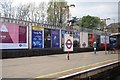
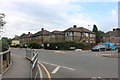
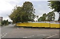

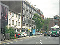
100 photos from this area
Area Information
Key information about the HA1 1SA including its size, population, and administrative classification.
- Area Type
- Postcode
- Area Size
- 1.2 hectares
- Population
- 2336
- Population Density
- 5712 people/km²
House Prices in HA1 1SA
48
Properties
£326,567
Average Sold Price
£10,000
Lowest Price
£775,000
Highest Price
Showing 48 properties
| Address | Type | Beds | Baths | Last Sale Price | Last Sale Date | |
|---|---|---|---|---|---|---|
| 78 Radnor Road, Harrow, HA1 1SA | Flat | - | - | £475,000 | Oct 2024 | |
| 43A Radnor Road, Harrow, HA1 1SA | Maisonette | 2 | 1 | £400,000 | Sep 2022 | |
| 45 Radnor Road, Harrow, HA1 1SA | Semi-detached | 6 | 2 | £775,000 | Sep 2022 | |
| 74 RADNOR ROAD, Harrow, HA1 1SA | Detached | - | - | £661,000 | Mar 2022 | |
| 58 Radnor Road, Harrow, HA1 1SA | Flat | - | - | £87,000 | Jan 2022 | |
| 58A Radnor Road, Harrow, HA1 1SA | Maisonette | 2 | 1 | £254,000 | Jun 2021 | |
| 41 Radnor Road, Harrow, HA1 1SA | Flat | - | - | £350,000 | Jun 2021 | |
| 72A Radnor Road, Harrow, HA1 1SA | Maisonette | 2 | 1 | £388,950 | Apr 2021 | |
| 64 Radnor Road, Harrow, HA1 1SA | house | - | - | £717,500 | Mar 2021 | |
| 53 Radnor Road, Harrow, HA1 1SA | Flat | - | - | £318,000 | Jun 2020 |
Page 1 of 5
Energy Efficiency in HA1 1SA
Amenities
Schools
| Rank | School | Type | Entry gender | Ages |
|---|
Explore more schools in this area
Go to Schools tabDemographics
Household Size
Family (3-5 people)
most common
Accommodation Type
Flats
most common
Tenure
62
majority
Ethnic Group
asian_total
most common
Religion
N/A
most common
Household Composition
N/A
most common
Age
47
median
Adults (30-64 years)
most common
Household Deprivation
N/A
with no deprivation
NS-SEC
41
in Lower managerial occupations
Explore more demographic insights in this area
Go to Demographics tabPlanning
Planning Constraints
- Flood RiskPremium
- Ramsar Wetland SitesPremium
- Area of Outstanding Natural BeautyPremium
- Protected Nature ReservePremium
- Protected WoodlandPremium