Area Overview for HA1 1QA
Photos of HA1 1QA

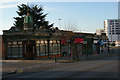
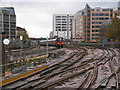
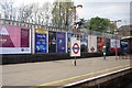
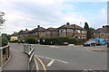

100 photos from this area
Area Information
Key information about the HA1 1QA including its size, population, and administrative classification.
- Area Type
- Postcode
- Area Size
- 5125 m²
- Population
- 2116
- Population Density
- 11569 people/km²
House Prices in HA1 1QA
34
Properties
£317,800
Average Sold Price
£81,750
Lowest Price
£598,000
Highest Price
Showing 34 properties
| Address | Type | Beds | Baths | Last Sale Price | Last Sale Date | |
|---|---|---|---|---|---|---|
| 18 St Kildas Road, Harrow, HA1 1QA | Maisonette | 2 | 1 | £530,000 | May 2025 | |
| 36 St Kildas Road, Harrow, HA1 1QA | Terraced | 3 | 2 | £550,000 | Mar 2025 | |
| 8 St Kildas Road, Harrow, HA1 1QA | Terraced | 2 | 1 | £558,500 | Jan 2025 | |
| 34 St Kildas Road, Harrow, HA1 1QA | house | 3 | - | £598,000 | Oct 2020 | |
| 2 St Kildas Road, Harrow, HA1 1QA | Flat | 1 | 1 | £299,500 | Mar 2018 | |
| 30 St Kildas Road, Harrow, HA1 1QA | Terraced | 3 | 1 | £520,000 | Dec 2017 | |
| 4 St Kildas Road, Harrow, HA1 1QA | Terraced | 3 | 1 | £271,000 | May 2011 | |
| 10 St Kildas Road, Harrow, HA1 1QA | Terraced | 2 | 2 | £249,000 | Jun 2006 | |
| 2A St Kildas Road, Harrow, HA1 1QA | Terraced | 4 | 2 | £180,000 | Jun 2005 | |
| 38 St Kildas Road, Harrow, HA1 1QA | Terraced | 1 | 2 | £267,500 | Aug 2004 |
Page 1 of 4
Energy Efficiency in HA1 1QA
Amenities
Schools
| Rank | School | Type | Entry gender | Ages |
|---|
Explore more schools in this area
Go to Schools tabDemographics
Household Size
Family (3-5 people)
most common
Accommodation Type
Flats
most common
Tenure
40
majority
Ethnic Group
White
most common
Religion
N/A
most common
Household Composition
N/A
most common
Age
47
median
Adults (30-64 years)
most common
Household Deprivation
N/A
with no deprivation
NS-SEC
35
in Lower managerial occupations
Explore more demographic insights in this area
Go to Demographics tabPlanning
Planning Constraints
- Flood RiskPremium
- Ramsar Wetland SitesPremium
- Area of Outstanding Natural BeautyPremium
- Protected Nature ReservePremium
- Protected WoodlandPremium