Area Overview for HA0 4QB
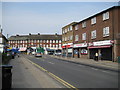
Photos of HA0 4QB


Area Information
HA0 4QB is a small residential cluster in England, covering 7,130 square metres and home to 2,404 people. Its population density is exceptionally high at 337,171 people per square kilometre, reflecting a compact, tightly knit community. The area is characterised by its flat-based housing stock, with a strong presence of Asian communities. Daily life here is shaped by proximity to urban infrastructure, with multiple transport hubs and retail outlets within walking distance. While the area lacks natural landscapes like AONBs or protected woodlands, its strategic location near Alperton and Wembley offers easy access to cultural and commercial amenities. The median age of 47 suggests a mature population, with a majority of residents aged 30–64. This demographic balance creates a stable, community-focused environment where local shops, transport links, and social hubs are integral to everyday living. For buyers, HA0 4QB presents a unique blend of urban convenience and residential density, though its small size means proximity to nearby areas is key for expanding lifestyle options.
- Area Type
- Postcode
- Area Size
- 7130 m²
- Population
- 2404
- Population Density
- 5555 people/km²
The property market in HA0 4QB is defined by its high density and flat-based housing stock. With 42% of homes owner-occupied, the area is not dominated by rental properties, though the proportion of renters suggests a significant portion of the population may be in transient or rental situations. The prevalence of flats indicates a focus on smaller, urban living units, which aligns with the area’s compact footprint. For buyers, this means limited availability of larger properties, with most options concentrated in multi-unit buildings. The small size of HA0 4QB also means that the immediate surrounding areas are critical for expanding housing choices. Potential buyers should consider the area’s proximity to transport links and amenities, which may offset the constraints of its limited internal housing stock. The market’s character is shaped by its demographic profile, with a mature population likely prioritising stability over expansion.
House Prices in HA0 4QB
No properties found in this postcode.
Energy Efficiency in HA0 4QB
Living in HA0 4QB offers access to a range of amenities within practical reach. Retail options include Lidl Alperton, Sainsburys Alperton, and Asda Alperton, providing everyday shopping convenience. Transport hubs like Alperton Station and Wembley Stadium ensure easy travel, while ferry stops such as Kew Pier and Little Venice Waterbus Stop add variety to commuting. The area’s proximity to Wembley Central Station and Stonebridge Park Station also facilitates quick access to London’s cultural and commercial centres. Though the data does not specify parks or leisure facilities, the density of retail and transport options suggests a focus on urban convenience. For residents, this means a lifestyle centred on accessibility, with minimal need to travel far for essentials or social activities. The compact nature of HA0 4QB ensures that daily life is efficient, though nearby areas may be necessary for broader recreational opportunities.
Amenities
Schools
| Rank | School | Type | Entry gender | Ages |
|---|
Explore more schools in this area
Go to Schools tabDemographics
The community in HA0 4QB is predominantly composed of adults aged 30–64, with a median age of 47. This suggests a mature, established population with strong ties to local institutions. Home ownership stands at 42%, indicating a mix of owner-occupied and rental properties. The accommodation type is largely flats, reflecting the area’s compact design and high density. The predominant ethnic group is Asian_total, which shapes the cultural fabric of the neighbourhood. While no specific deprivation data is provided, the high population density and reliance on rental housing may influence the cost of living and access to services. The absence of detailed diversity metrics means the area’s social composition is understood primarily through the dominant ethnic group. For residents, this demographic profile implies a stable, community-driven environment with a focus on local amenities and social cohesion.
Household Size
Accommodation Type
Tenure
Ethnic Group
Religion
Household Composition
Age
Household Deprivation
NS-SEC
Explore more demographic insights in this area
Go to Demographics tabPlanning
Planning Constraints
- Flood RiskPremium
- Ramsar Wetland SitesPremium
- Area of Outstanding Natural BeautyPremium
- Protected Nature ReservePremium
- Protected WoodlandPremium