Area Overview for HA0 4HY
Photos of HA0 4HY


Area Information
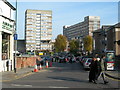
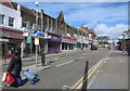
HA0 4HY is a small, tightly knit residential postcode in England, home to around 2,200 people. Its compact size means it feels more like a close-knit village than a sprawling suburb, with a distinct character shaped by its demographics and amenities. The area is predominantly occupied by adults aged 30–64, many of whom own their homes. This suggests a stable, family-oriented community with a mature population profile. Living here offers proximity to essential services, including multiple retail outlets, transport hubs, and schools. The postcode’s location near major transport links, such as Alperton and Sudbury Town stations, ensures easy access to London’s broader network. For those prioritising convenience, the area’s digital connectivity is near flawless, with broadband scores at 99. While it lacks natural reserves or protected landscapes, its safety record—low crime and flood risks—makes it appealing for families seeking a secure, practical place to live.
- Area Type
- Postcode
- Area Size
- Not available
- Population
- 2196
- Population Density
- 9661 people/km²
HA0 4HY is a predominantly owner-occupied area, with 60% of homes owned by residents rather than rented. The accommodation type is largely houses, which suggests a focus on family homes and stable, long-term living. This contrasts with areas dominated by apartments or rental properties, where turnover is often higher. The small size of the postcode means the housing stock is limited, and buyers should consider proximity to amenities and transport when evaluating properties. The presence of multiple retail outlets and transport hubs nearby may influence property values, as these features enhance convenience. For those seeking a home with a sense of permanence, HA0 4HY offers a blend of practicality and community, though the limited number of properties could mean competition for available listings.
House Prices in HA0 4HY
No properties found in this postcode.
Energy Efficiency in HA0 4HY
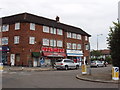
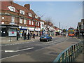
Residents of HA0 4HY enjoy a range of amenities within walking or short-vehicle distance. The area includes five retail outlets such as Lidl Alperton, Co-op Alperton, and Sainsburys Alperton, providing everyday shopping convenience. Transport hubs like Alperton Station and Wembley Central Station make commuting or weekend travel straightforward. For leisure, the nearby waterbus stops at Kew Pier and London Zoo offer access to riverside activities and cultural attractions. The presence of RAF Northolt, the only airport listed, adds to the area’s connectivity for travel. While the postcode lacks large parks or green spaces, its proximity to transport and retail ensures a practical lifestyle. The mix of services supports both daily needs and occasional outings, contributing to a balanced, accessible living environment.
Amenities
Schools
Residents of HA0 4HY have access to two primary schools: Lyon Park Junior School and Lyon Park Primary School. The latter is rated ‘good’ by Ofsted, offering a reliable educational option for younger children. The presence of two primary schools in close proximity suggests a focus on family needs, with parents able to choose between institutions based on their preferences. While no secondary schools are listed in the data, the proximity to larger transport hubs like Wembley Central Station may provide access to broader educational opportunities in nearby areas. The mix of schools ensures that children can begin their education in a supportive environment, though families requiring secondary schooling may need to look further afield.
| Rank | School | Type | Entry gender | Ages |
|---|
Explore more schools in this area
Go to Schools tabDemographics
The population of HA0 4HY is 2,196, with a median age of 47. The majority of residents fall within the 30–64 age range, indicating a community of established adults, many of whom may be raising families or in their professional prime. Home ownership is strong, with 60% of households owning their homes, suggesting a mix of long-term residents and those seeking stability. The predominant accommodation type is houses, which aligns with the age profile and ownership rates. The area’s ethnic diversity is notable, with the Asian_total group forming the largest proportion of the population. This contributes to a culturally rich environment, though specific data on deprivation or income levels is not provided. The absence of younger demographics or student populations means the area is less likely to experience rapid change or gentrification, offering a consistent, mature community feel.
Household Size
Accommodation Type
Tenure
Ethnic Group
Religion
Household Composition
Age
Household Deprivation
NS-SEC
Explore more demographic insights in this area
Go to Demographics tabPlanning
Planning Constraints
- Flood RiskPremium
- Ramsar Wetland SitesPremium
- Area of Outstanding Natural BeautyPremium
- Protected Nature ReservePremium
- Protected WoodlandPremium