Area Overview for HA0 2TG
Photos of HA0 2TG
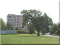
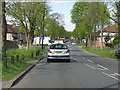
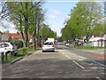

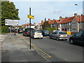
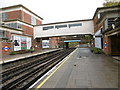
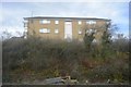
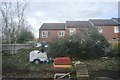
65 photos from this area
Area Information
Key information about the HA0 2TG including its size, population, and administrative classification.
- Area Type
- Postcode
- Area Size
- 1.1 hectares
- Population
- 1872
- Population Density
- 7949 people/km²
House Prices in HA0 2TG
41
Properties
£296,612
Average Sold Price
£55,000
Lowest Price
£500,000
Highest Price
Showing 41 properties
| Address | Type | Beds | Baths | Last Sale Price | Last Sale Date | |
|---|---|---|---|---|---|---|
| 1 Maybank Avenue, Wembley, HA0 2TG | Terraced | 3 | 1 | £500,000 | Jul 2025 | |
| 29 Maybank Avenue, Wembley, HA0 2TG | Terraced | 3 | 2 | £497,000 | Oct 2024 | |
| 57 Maybank Avenue, Wembley, HA0 2TG | Terraced | 3 | 1 | £460,000 | Apr 2021 | |
| 21 Maybank Avenue, Wembley, HA0 2TG | Terraced | 3 | 2 | £453,000 | Mar 2016 | |
| 13 Maybank Avenue, Wembley, HA0 2TG | Terraced | 4 | 2 | £495,000 | Dec 2015 | |
| 15 Maybank Avenue, Wembley, HA0 2TG | Terraced | 3 | 1 | £374,950 | Jan 2015 | |
| 43 Maybank Avenue, Wembley, HA0 2TG | house | - | - | £291,000 | Feb 2008 | |
| 59 Maybank Avenue, Wembley, HA0 2TG | Maisonette | 1 | 1 | £250,000 | Oct 2006 | |
| 39 Maybank Avenue, Wembley, HA0 2TG | Flat | 1 | 1 | £60,000 | Oct 2002 | |
| 19 Maybank Avenue, Wembley, HA0 2TG | Terraced | 3 | 1 | £175,000 | Aug 2002 |
Page 1 of 5
Energy Efficiency in HA0 2TG
Amenities
Schools
| Rank | School | Type | Entry gender | Ages |
|---|
Explore more schools in this area
Go to Schools tabDemographics
Household Size
Family (3-5 people)
most common
Accommodation Type
Houses
most common
Tenure
46
majority
Ethnic Group
asian_total
most common
Religion
N/A
most common
Household Composition
N/A
most common
Age
47
median
Adults (30-64 years)
most common
Household Deprivation
N/A
with no deprivation
NS-SEC
19
in Lower managerial occupations
Explore more demographic insights in this area
Go to Demographics tabPlanning
Planning Constraints
- Flood RiskPremium
- Ramsar Wetland SitesPremium
- Area of Outstanding Natural BeautyPremium
- Protected Nature ReservePremium
- Protected WoodlandPremium