Area Overview for HA0 2LE
Photos of HA0 2LE
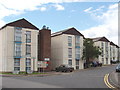

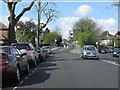

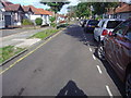
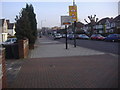


82 photos from this area
Area Information
Key information about the HA0 2LE including its size, population, and administrative classification.
- Area Type
- Postcode
- Area Size
- 9631 m²
- Population
- 1928
- Population Density
- 15662 people/km²
House Prices in HA0 2LE
44
Properties
£269,743
Average Sold Price
£73,900
Lowest Price
£510,000
Highest Price
Showing 44 properties
| Address | Type | Beds | Baths | Last Sale Price | Last Sale Date | |
|---|---|---|---|---|---|---|
| 11A District Road, Wembley, HA0 2LE | Retail | 2 | 1 | £380,000 | Dec 2022 | |
| 51A District Road, Wembley, HA0 2LE | Bungalow | 1 | 1 | £490,000 | Jan 2020 | |
| 7 District Road, Wembley, HA0 2LE | Flat | - | - | £295,000 | Jan 2020 | |
| 3 District Road, Wembley, HA0 2LE | Semi-detached | 4 | - | £510,000 | Dec 2019 | |
| 5D District Road, Wembley, HA0 2LE | Flat | 1 | 1 | £220,000 | Apr 2018 | |
| 7A District Road, Wembley, HA0 2LE | Flat | 2 | - | £360,000 | Jan 2017 | |
| 33 District Road, Wembley, HA0 2LE | Flat | - | - | £195,000 | Jul 2012 | |
| 11 District Road, Wembley, HA0 2LE | Flat | - | - | £195,500 | Dec 2006 | |
| 47 District Road, Wembley, HA0 2LE | Detached | 2 | 1 | £375,000 | Aug 2006 | |
| 41 District Road, Wembley, HA0 2LE | Semi-detached | - | - | £317,500 | Nov 2003 |
Page 1 of 5
Energy Efficiency in HA0 2LE
Amenities
Schools
| Rank | School | Type | Entry gender | Ages |
|---|
Explore more schools in this area
Go to Schools tabDemographics
Household Size
Family (3-5 people)
most common
Accommodation Type
Flats
most common
Tenure
55
majority
Ethnic Group
asian_total
most common
Religion
N/A
most common
Household Composition
N/A
most common
Age
47
median
Adults (30-64 years)
most common
Household Deprivation
N/A
with no deprivation
NS-SEC
28
in Lower managerial occupations
Explore more demographic insights in this area
Go to Demographics tabPlanning
Planning Constraints
- Flood RiskPremium
- Ramsar Wetland SitesPremium
- Area of Outstanding Natural BeautyPremium
- Protected Nature ReservePremium
- Protected WoodlandPremium