Area Overview for HA0 2BS
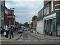
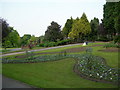
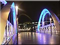
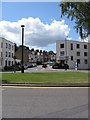
Photos of HA0 2BS
Area Information
HA0 2BS is a compact residential postcode in England, covering just 5,948 square metres and home to 2,008 residents. Its high population density of 337,592 people per square kilometre reflects a tightly packed community, typical of urban or semi-urban settings. The area is characterised by its proximity to Wembley, offering easy access to major landmarks like Wembley Stadium and nearby transport hubs. Daily life here is shaped by the surrounding infrastructure, with a mix of retail, transport, and leisure options within reach. The area’s small size means it is likely part of a larger residential cluster, with residents relying on nearby amenities for shopping, travel, and recreation. While the community is small, it is connected to broader networks, including rail, metro, and ferry services, making it a practical choice for those prioritising connectivity. The demographic profile—predominantly adults aged 30–64, with a strong Asian presence—suggests a mature, established population, which may influence the area’s social dynamics and local services.
- Area Type
- Postcode
- Area Size
- 5948 m²
- Population
- 2008
- Population Density
- 13073 people/km²
The property market in HA0 2BS is dominated by flats, with home ownership at 35%, indicating that the majority of residents are likely to be renters rather than homeowners. This suggests a rental market that may be competitive, particularly in a small area with limited housing stock. The prevalence of flats implies a focus on smaller, manageable living spaces, which could appeal to individuals or couples without children. For buyers, the small size of the postcode means the available housing is concentrated, potentially limiting options. However, the proximity to transport links and amenities like Wembley Stadium and nearby retail hubs may offset the constraints of the area’s size. Prospective buyers should consider the high population density and the predominance of rental properties when evaluating long-term investment potential.
House Prices in HA0 2BS
Showing 43 properties
| Address | Type | Beds | Baths | Last Sale Price | Last Sale Date | |
|---|---|---|---|---|---|---|
| 32 Turton Road, Wembley, HA0 2BS | Terraced | 3 | 1 | £475,000 | Jan 2024 | |
| 30 Turton Road, Wembley, HA0 2BS | Flat | 1 | - | £277,000 | May 2019 | |
| 28 Turton Road, Wembley, HA0 2BS | Flat | 1 | 1 | £310,000 | Feb 2016 | |
| 9 Turton Road, Wembley, HA0 2BS | Terraced | 3 | - | £350,000 | Feb 2015 | |
| 2 Turton Road, Wembley, HA0 2BS | house | - | - | £310,000 | Dec 2014 | |
| 35 Turton Road, Wembley, HA0 2BS | house | - | - | £185,000 | May 2011 | |
| 7 Turton Road, Wembley, HA0 2BS | Terraced | 5 | 2 | £250,000 | Dec 2010 | |
| 23 Turton Road, Wembley, HA0 2BS | house | - | - | £232,000 | Dec 2009 | |
| 24 Turton Road, Wembley, HA0 2BS | Terraced | - | - | £250,000 | Aug 2006 | |
| 21 Turton Road, Wembley, HA0 2BS | Terraced | 3 | 1 | £220,000 | Jun 2005 |
Energy Efficiency in HA0 2BS
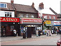
Living in HA0 2BS offers access to a range of amenities, including retail, transport, and leisure options. The area is within walking distance of major retailers like Iceland Wembley and Tesco Wembley, providing convenience for daily shopping. Transport links are extensive, with five rail stations, three metro stops, and ferry services connecting residents to Wembley Stadium, central London, and beyond. The nearby RAF Northolt adds a unique dimension to the area’s character. For leisure, the proximity to Wembley Stadium and waterbus stops like Little Venice and London Zoo Waterbus Stop offer opportunities for events, outdoor activities, and cultural experiences. While the area’s small size means amenities are concentrated, the variety of shops, transport hubs, and recreational options suggests a practical, accessible lifestyle. The mix of retail and transport infrastructure supports both daily needs and broader mobility, making it suitable for those prioritising convenience.
Amenities
Schools
The nearest school to HA0 2BS is Park Lane Primary School, which serves the local community with a good Ofsted rating. This school is a key resource for families with young children, offering a reliable primary education. However, the data does not include secondary schools or further education institutions, meaning families may need to look beyond the immediate area for secondary schooling. The presence of a primary school with a good rating is a positive factor for parents prioritising quality education, though the absence of higher-level schools could influence decisions for those requiring a full range of educational options. The school’s performance suggests a focus on foundational learning, which may align with the area’s demographic of older adults and families.
| Rank | School | Type | Entry gender | Ages |
|---|
Explore more schools in this area
Go to Schools tabDemographics
The population of HA0 2BS is 2,008, with a median age of 47, indicating a mature demographic skewed towards adults aged 30–64. Home ownership here is relatively low at 35%, suggesting a higher proportion of renters compared to owner-occupiers. The primary accommodation type is flats, reflecting a housing stock suited to smaller households or those prioritising ease of maintenance. The predominant ethnic group is Asian_total, which shapes the community’s cultural and social fabric. With a population density of 337,592 people per square kilometre, the area is highly compact, which can influence living conditions, such as limited private outdoor space. This density may also contribute to a sense of community cohesion, though it could pose challenges in terms of overcrowding or resource allocation. The demographic profile suggests a stable, established population, likely with strong ties to local services and amenities.
Household Size
Accommodation Type
Tenure
Ethnic Group
Religion
Household Composition
Age
Household Deprivation
NS-SEC
Explore more demographic insights in this area
Go to Demographics tabPlanning
Planning Constraints
- Flood RiskPremium
- Ramsar Wetland SitesPremium
- Area of Outstanding Natural BeautyPremium
- Protected Nature ReservePremium
- Protected WoodlandPremium