Area Overview for HA0 2AF
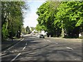
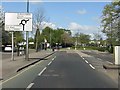
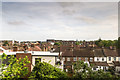
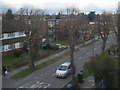
Photos of HA0 2AF


Area Information
HA0 2AF is a small residential cluster in England, covering just 4,742 square metres and home to 2,642 people. The area’s compact size and high population density—over 557,000 people per square kilometre—suggest a tightly knit community. This postcode area is distinct for its concentration of flats, reflecting a housing stock tailored to urban living. The median age of 47 indicates a mature demographic, with the majority of residents falling between 30 and 64 years old. Daily life here is shaped by proximity to transport hubs and retail centres, with easy access to Wembley’s amenities. While the area lacks natural landscapes like AONB or protected woodlands, its strategic location near Wembley Central Station and major retail outlets such as Iceland Wembley and Tesco Wembley ensures convenience for commuters and shoppers. Living in HA0 2AF means navigating a high-density environment with a focus on connectivity, though the absence of green spaces may be a consideration for those prioritising natural surroundings.
- Area Type
- Postcode
- Area Size
- 4742 m²
- Population
- 2642
- Population Density
- 15658 people/km²
The property market in HA0 2AF is characterised by a high proportion of rental properties, with only 37% of homes owned by residents. The accommodation type is overwhelmingly flats, which are typical in high-density urban areas. This suggests a market geared towards tenants rather than long-term buyers, possibly due to the area’s compact size and limited scope for expansion. The small footprint of 4,742 square metres means the housing stock is concentrated, with little room for new developments. For buyers, this implies a limited selection of properties, all of which are likely to be flats rather than detached or semi-detached homes. The area’s proximity to Wembley’s transport links and retail centres may offset the lack of private space, appealing to those prioritising convenience over living area. However, the high population density and rental dominance suggest competition for available properties, with prices potentially influenced by demand from commuters and workers in nearby sectors.
House Prices in HA0 2AF
Showing 34 properties
| Address | Type | Beds | Baths | Last Sale Price | Last Sale Date | |
|---|---|---|---|---|---|---|
| 592C High Road, Wembley, HA0 2AF | Flat | 2 | - | £223,000 | Feb 2015 | |
| 592B High Road, Wembley, HA0 2AF | Maisonette | 2 | - | - | - | |
| 594A High Road, Wembley, HA0 2AF | Flat | - | 1 | - | - | |
| 590 High Road, Wembley, HA0 2AF | Flat | - | - | - | - | |
| Flat 7, 586 High Road, Wembley, HA0 2AF | Flat | 2 | - | - | - | |
| Flat 3, 586 High Road, Wembley, HA0 2AF | Flat | 2 | - | - | - | |
| Flat 2, 586 High Road, Wembley, HA0 2AF | Flat | 2 | - | - | - | |
| Flat 1, 586 High Road, Wembley, HA0 2AF | Flat | 2 | 2 | - | - | |
| Flat 9, 586 High Road, Wembley, HA0 2AF | Flat | 2 | 2 | - | - | |
| Flat 6, 586 High Road, Wembley, HA0 2AF | Flat | 2 | - | - | - |
Energy Efficiency in HA0 2AF
Residents of HA0 2AF have access to a range of amenities within practical reach, including five retail outlets such as Iceland Wembley and Tesco Wembley, offering everyday shopping convenience. The area’s transport links provide easy access to Wembley Stadium, Sudbury & Harrow Road, and other key locations, making it ideal for those working in or visiting the area. For leisure, the proximity to London Zoo Waterbus Stop and Little Venice Waterbus Stop opens up opportunities for water-based activities. The presence of multiple rail and metro stations, including Wembley Central and Sudbury Town, ensures seamless travel to nearby attractions and employment hubs. While there are no nearby parks or green spaces listed, the area’s focus on retail, transport, and urban connectivity shapes a lifestyle centred on convenience rather than natural landscapes. The mix of retail, transport, and waterway access creates a dynamic environment, though those seeking more open spaces may need to travel further.
Amenities
Schools
| Rank | School | Type | Entry gender | Ages |
|---|
Explore more schools in this area
Go to Schools tabDemographics
The community in HA0 2AF is predominantly composed of adults aged 30 to 64, with a median age of 47. Only 37% of residents own their homes, suggesting a rental market that dominates this area. The accommodation type is almost exclusively flats, reflecting a housing model suited to urban density. The predominant ethnic group is Asian, which shapes the cultural fabric of the neighbourhood. With 2,642 residents in a space of 4,742 square metres, the area’s population density is exceptionally high—over 557,000 people per square kilometre—implying a tightly packed living environment. This density may influence daily life, with limited private outdoor space and a reliance on shared communal areas. The demographic profile suggests a stable, middle-aged population, likely with established careers and families, though the low home ownership rate indicates a transient element. The absence of specific deprivation data means quality of life factors like access to services and employment opportunities remain unquantified, but the proximity to retail and transport hubs implies functional infrastructure.
Household Size
Accommodation Type
Tenure
Ethnic Group
Religion
Household Composition
Age
Household Deprivation
NS-SEC
Explore more demographic insights in this area
Go to Demographics tabPlanning
Planning Constraints
- Flood RiskPremium
- Ramsar Wetland SitesPremium
- Area of Outstanding Natural BeautyPremium
- Protected Nature ReservePremium
- Protected WoodlandPremium