Area Overview for HA0 1UG
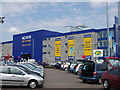
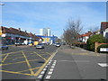
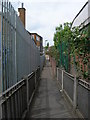
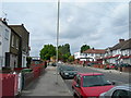
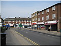
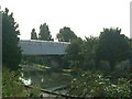
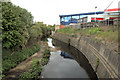
Photos of HA0 1UG

Area Information
HA0 1UG is a compact residential postcode in England, covering just 4,885 square metres and home to 2,528 residents. Its high population density of 517,469 people per square kilometre reflects a tightly packed community, typical of urban clusters. The area’s character is shaped by its proximity to transport hubs and retail centres, with five metro stations within reach, including Alperton and Hanger Lane. Daily life here is defined by convenience, with easy access to shops like Lidl and Sainsburys, as well as rail links to Wembley and nearby airports. The predominantly Asian population, with a median age of 47, suggests a mature, established community. While the area lacks natural reserves or protected landscapes, its low flood risk and crime score of 72 make it an attractive option for those prioritising safety and practicality. Living in HA0 1UG means navigating a densely populated, amenity-rich environment where modern connectivity and transport options are key.
- Area Type
- Postcode
- Area Size
- 4885 m²
- Population
- 2528
- Population Density
- 13160 people/km²
HA0 1UG’s property market is characterised by a 47% home ownership rate, with houses being the primary accommodation type. This suggests a mix of owner-occupied and rental properties, though the exact proportion of rentals is not specified. The small area size and high population density indicate a compact housing stock, likely centred on terraced or semi-detached homes. For buyers, this means a limited number of properties available, with competition likely among those seeking homes in a densely populated, amenity-rich zone. The presence of nearby retail and transport links may enhance property value, but the small footprint of the postcode means buyers must consider immediate surroundings for additional options. The lack of high-rise or commercial development points to a residential focus, making it suitable for those prioritising proximity to services over space.
House Prices in HA0 1UG
Showing 23 properties
| Address | Type | Beds | Baths | Last Sale Price | Last Sale Date | |
|---|---|---|---|---|---|---|
| 114 Mount Pleasant, Wembley, HA0 1UG | Terraced | 3 | 1 | £589,950 | Mar 2025 | |
| 90 Mount Pleasant, Wembley, HA0 1UG | Semi-detached | 3 | 1 | £485,000 | Feb 2020 | |
| 86 Mount Pleasant, Wembley, HA0 1UG | Terraced | 3 | 2 | £510,000 | Dec 2018 | |
| 120 Mount Pleasant, Wembley, HA0 1UG | Terraced | 3 | 1 | £416,000 | Sep 2015 | |
| 88 Mount Pleasant, Wembley, HA0 1UG | house | - | - | £270,000 | Sep 2005 | |
| 92 Mount Pleasant, Wembley, HA0 1UG | Flat | - | - | £152,000 | Aug 2004 | |
| 108 Mount Pleasant, Wembley, HA0 1UG | Terraced | - | - | £138,000 | Mar 2001 | |
| 106 Mount Pleasant, Wembley, HA0 1UG | Terraced | - | - | £135,000 | May 2000 | |
| 122 Mount Pleasant, Wembley, HA0 1UG | Terraced | 3 | 1 | £149,750 | Sep 1999 | |
| 112 Mount Pleasant, Wembley, HA0 1UG | Terraced | - | - | £52,800 | Feb 1999 |
Energy Efficiency in HA0 1UG
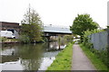
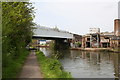
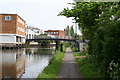
Living in HA0 1UG offers access to a range of amenities within practical reach. Retail options include Lidl Alperton, Co-op Alperton, and Sainsburys Alperton, ensuring everyday shopping needs are met. The area’s transport links connect residents to cultural and recreational sites, such as London Zoo via waterbus stops and Wembley Stadium for events. Five metro stations, including Hanger Lane and Park Royal, provide easy access to nearby business districts and leisure spots. While the area lacks parks or green spaces, its proximity to transport hubs and retail centres creates a dynamic, convenience-driven lifestyle. The presence of RAF Northolt and waterbus routes adds to its accessibility, making HA0 1UG ideal for those prioritising connectivity over natural landscapes.
Amenities
Schools
| Rank | School | Type | Entry gender | Ages |
|---|
Explore more schools in this area
Go to Schools tabDemographics
The population of HA0 1UG skews towards adults aged 30–64, with a median age of 47. This suggests a community of settled, working-age residents, likely with families. Home ownership sits at 47%, indicating a mix of owner-occupied and rental properties, though the accommodation type is predominantly houses. The area’s predominant ethnic group is Asian_total, reflecting a culturally distinct demographic. With a population density of 517,469 per square kilometre, the area is intensely populated, which can influence the pace of life and availability of services. While no specific deprivation data is provided, the high density and access to amenities like supermarkets and rail stations imply a functional, if crowded, quality of life. The absence of significant age groups under 30 or over 65 suggests a community focused on middle-aged stability rather than youth or retirement.
Household Size
Accommodation Type
Tenure
Ethnic Group
Religion
Household Composition
Age
Household Deprivation
NS-SEC
Explore more demographic insights in this area
Go to Demographics tabPlanning
Planning Constraints
- Flood RiskPremium
- Ramsar Wetland SitesPremium
- Area of Outstanding Natural BeautyPremium
- Protected Nature ReservePremium
- Protected WoodlandPremium