Area Overview for HA0 1SS
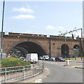
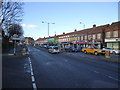
Photos of HA0 1SS


Area Information
HA0 1SS is a small residential cluster in England, covering just 1.8 hectares and home to 2,376 residents. Its high population density of 133,304 people per square kilometre reflects a compact, tightly knit community. This postcode is notable for its demographic profile, with a median age of 47 and a majority of residents aged 30–64. The area is characterised by a predominance of flats, reflecting a housing stock shaped by shared ownership and rental tenures. While the area lacks protected natural sites or flood risks, its proximity to transport hubs and retail centres makes it a practical choice for those prioritising connectivity. Living in HA0 1SS means navigating a dense urban environment with a strong emphasis on accessibility. The absence of major planning constraints and the low flood risk score of 2.22 suggest a stable, if not expansive, living environment. However, the medium crime risk score of 48 means residents should remain mindful of standard security measures. For buyers, HA0 1SS offers a compact, functional postcode with a clear focus on proximity to services rather than open space.
- Area Type
- Postcode
- Area Size
- 1.8 hectares
- Population
- 2376
- Population Density
- 6170 people/km²
The property market in HA0 1SS is defined by a 45% home ownership rate, meaning nearly half of the housing stock is rented. The predominance of flats indicates a focus on shared or multi-unit living, which is typical in high-density urban areas. This suggests that the area is more aligned with rental markets than owner-occupation, though the exact proportion of buy-to-let properties is not specified. For buyers, the small area size and high population density mean competition for properties is likely fierce, with limited scope for expansion or redevelopment. The flat-dominated market may appeal to those seeking affordability or proximity to transport, but buyers should consider the long-term implications of living in a densely populated postcode. The lack of protected natural sites or planning constraints may offer flexibility for future use, though the medium crime risk score of 48 could affect desirability for some.
House Prices in HA0 1SS
Showing 25 properties
Energy Efficiency in HA0 1SS
Living in HA0 1SS grants access to a range of amenities within practical reach. Retail options include Co-op Alperton, Tesco Harlesden, and Sainsburys Wembley, ensuring daily shopping needs are met. The area’s transport links also provide access to leisure spots like Wembley Stadium and London Zoo via waterbus services. Parks and open spaces are less prominent in the data, but the absence of protected natural sites suggests a focus on urban convenience rather than greenery. Dining options are not explicitly listed, but the proximity to major stations implies a variety of eateries nearby. The presence of multiple rail and metro stations enhances the area’s connectivity, making it easy to reach cultural and commercial centres. For residents, the lifestyle in HA0 1SS balances practicality with accessibility, though the compact size may limit opportunities for outdoor recreation.
Amenities
Schools
| Rank | School | Type | Entry gender | Ages |
|---|
Explore more schools in this area
Go to Schools tabDemographics
The community in HA0 1SS is predominantly composed of adults aged 30–64, with a median age of 47. This suggests a mature population, likely with established careers and families. Home ownership here is relatively low at 45%, indicating a higher proportion of renters compared to owner-occupied properties. The accommodation type is largely flats, which aligns with the area’s high density. The predominant ethnic group is Asian_total, reflecting a culturally diverse demographic. This diversity contributes to the area’s social fabric, though specific data on deprivation or income levels is not provided. The population density of 133,304 people per square kilometre means the area is intensely populated, which can influence the availability of private outdoor space and community dynamics. For residents, this density offers convenience in proximity to amenities but may limit the sense of personal space. The combination of age profile and housing stock suggests a community that values accessibility over expansive living quarters.
Household Size
Accommodation Type
Tenure
Ethnic Group
Religion
Household Composition
Age
Household Deprivation
NS-SEC
Explore more demographic insights in this area
Go to Demographics tabPlanning
Planning Constraints
- Flood RiskPremium
- Ramsar Wetland SitesPremium
- Area of Outstanding Natural BeautyPremium
- Protected Nature ReservePremium
- Protected WoodlandPremium