Area Overview for HA0 1NL
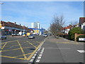
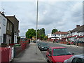
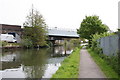
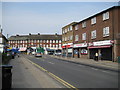
Photos of HA0 1NL


Area Information
HA0 1NL is a small, densely populated residential postcode in England, covering just 1.7 hectares and home to 2,376 people. With a population density of 140,898 people per square kilometre, this area is a compact cluster of flats, reflecting a community shaped by urban living. The median age of 47 and a majority of residents aged 30–64 suggest a mature, established population, many of whom may be long-term residents. The area’s proximity to transport hubs and retail centres makes it a practical choice for those prioritising connectivity over space. While the high density can feel cramped, the presence of multiple metro, rail, and ferry options ensures residents are never far from London’s broader networks. This postcode is ideal for commuters and those who value accessibility over expansive living spaces, though the small area size means the housing stock is limited to a tightly packed cluster of flats.
- Area Type
- Postcode
- Area Size
- 1.7 hectares
- Population
- 2376
- Population Density
- 6170 people/km²
HA0 1NL is a rental-dominated area, with only 45% of residents owning their homes. The housing stock is almost entirely composed of flats, reflecting the small area’s compact nature and the demand for space-efficient living. This makes the property market limited in scope, with few opportunities for buyers seeking larger homes or private ownership. The area’s proximity to transport links like Hanger Lane Station and Wembley Central Station may make it appealing to commuters, but the small size means the immediate surroundings offer little in terms of property diversity. Buyers should consider the challenges of a high-density environment, where flats are the only available option, and weigh this against the convenience of being near major transport routes and retail hubs.
House Prices in HA0 1NL
No properties found in this postcode.
Energy Efficiency in HA0 1NL
Living in HA0 1NL offers access to a range of amenities within short distances. Retail options include Asda Alperton, Co-op Alperton, and Lidl Alperton, providing everyday shopping convenience. Transport links are extensive, with metro stations like Hanger Lane and Park Royal, rail services to Wembley Central and Stonebridge Park, and ferry stops at Kew Pier and Richmond St. Helena Pier. The area’s proximity to Wembley Stadium and nearby leisure spots adds to its appeal. While the housing stock is limited to flats, the density of amenities ensures residents can meet most needs locally, from grocery shopping to commuting. The mix of retail, transport, and leisure options makes daily life in HA0 1NL practical and efficient.
Amenities
Schools
| Rank | School | Type | Entry gender | Ages |
|---|
Explore more schools in this area
Go to Schools tabDemographics
The community in HA0 1NL is predominantly Asian, with 45% of residents owning their homes and 55% renting. The median age of 47 and a peak age range of 30–64 indicate a population that is largely settled, with fewer young families or retirees. The high population density of 140,898 people per square kilometre means living spaces are shared among a large number of people, which can influence the area’s social dynamics. The flats that dominate the housing stock suggest a focus on efficiency rather than private ownership. While the data does not specify deprivation levels, the high density and reliance on rental housing may indicate a mix of economic profiles, with some residents potentially facing higher living costs relative to income.
Household Size
Accommodation Type
Tenure
Ethnic Group
Religion
Household Composition
Age
Household Deprivation
NS-SEC
Explore more demographic insights in this area
Go to Demographics tabPlanning
Planning Constraints
- Flood RiskPremium
- Ramsar Wetland SitesPremium
- Area of Outstanding Natural BeautyPremium
- Protected Nature ReservePremium
- Protected WoodlandPremium