Area Overview for HA0 1DL
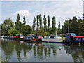
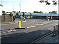
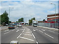
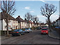
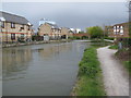
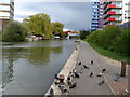
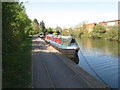
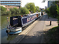
Photos of HA0 1DL


Area Information
Living in HA0 1DL means being part of a tightly knit residential cluster in England, where 1,758 people reside across just 1.1 hectares. The area’s compact size creates a dense, community-oriented environment, with a population density of 159,539 people per square kilometre. This small postcode is defined by its proximity to essential services and transport links, making daily life convenient for residents. The area’s demographic profile suggests a mature population, with a median age of 47 and a strong presence of adults aged 30–64. While the predominant ethnic group is Asian, the community is likely diverse in practice. HA0 1DL’s appeal lies in its accessibility to nearby amenities, from retail hubs to public transport, balanced with the quietude of a small, focused postcode. For those seeking a compact, well-connected living space without the sprawl of larger urban areas, this postcode offers a blend of practicality and proximity to key resources.
- Area Type
- Postcode
- Area Size
- 1.1 hectares
- Population
- 1758
- Population Density
- 9707 people/km²
The property market in HA0 1DL is dominated by owner-occupied homes, with 64% of residents owning their properties. This suggests a stable market where long-term residency is common, though the small area size—just 1.1 hectares—means the housing stock is limited. The predominance of houses over flats indicates a focus on family homes, likely with larger gardens or more spacious layouts. Given the high population density, properties in HA0 1DL are likely in demand, particularly for those seeking proximity to transport and amenities. However, the compact nature of the postcode means buyers must consider nearby areas for additional options. For those prioritising ownership, the market offers a mix of established homes, though competition for available properties may be fierce. The absence of rental data implies that the area is not a primary destination for renters, instead catering to those with a preference for homeownership.
House Prices in HA0 1DL
Showing 23 properties
| Address | Type | Beds | Baths | Last Sale Price | Last Sale Date | |
|---|---|---|---|---|---|---|
| 1 Lily Gardens, Wembley, HA0 1DL | Semi-detached | 3 | 2 | £505,000 | Dec 2023 | |
| 3 Lily Gardens, Wembley, HA0 1DL | Semi-detached | 3 | 1 | £465,000 | Jun 2021 | |
| 9 Lily Gardens, Wembley, HA0 1DL | Semi-detached | 3 | 1 | £515,000 | Oct 2018 | |
| 5 Lily Gardens, Wembley, HA0 1DL | Semi-detached | 3 | 1 | £415,000 | Feb 2018 | |
| 35 Lily Gardens, Wembley, HA0 1DL | Semi-detached | 3 | 1 | £325,000 | Dec 2013 | |
| 17 Lily Gardens, Wembley, HA0 1DL | house | - | - | £250,000 | Nov 2012 | |
| 25 Lily Gardens, Wembley, HA0 1DL | house | 3 | 1 | £277,000 | May 2012 | |
| 19 Lily Gardens, Wembley, HA0 1DL | house | - | - | £250,000 | May 2011 | |
| 39 Lily Gardens, Wembley, HA0 1DL | house | - | - | £226,000 | May 2003 | |
| 27 Lily Gardens, Wembley, HA0 1DL | Semi-detached | - | - | £208,000 | Mar 2003 |
Energy Efficiency in HA0 1DL
Living in HA0 1DL grants access to a range of amenities within practical reach. Retail options include Sainsburys Alperton, Tesco Greenford, and Asda Alperton, ensuring everyday shopping needs are met. Transport links are extensive, with metro, rail, and ferry services nearby, including Alperton Station, Hanger Lane Station, and Richmond St. Helena Pier. The area’s proximity to RAF Northolt adds a distinct character. For leisure, the surrounding region offers parks and open spaces, though specific names are not listed. The combination of retail, transport, and strategic location creates a convenient lifestyle, balancing urban accessibility with the practicality of a compact postcode. Residents can enjoy a mix of daily essentials and connectivity, making HA0 1DL suitable for those prioritising convenience and proximity to services.
Amenities
Schools
The nearest school to HA0 1DL is Vicar’s Green Primary School, which holds an outstanding Ofsted rating. This indicates a high standard of education for younger children, though no secondary schools are listed in the data. Families with children will need to look beyond the immediate area for secondary education options. The presence of a top-rated primary school is a significant draw for parents prioritising early education quality. However, the lack of secondary school data means prospective buyers should investigate nearby districts for comprehensive schooling. For those focused on primary education, Vicar’s Green Primary School offers a reliable foundation, but the broader educational landscape for older children remains unclear.
| Rank | School | Type | Entry gender | Ages |
|---|
Explore more schools in this area
Go to Schools tabDemographics
HA0 1DL’s population is predominantly composed of adults aged 30–64, reflecting a mature community with a median age of 47. Home ownership is high, with 64% of residents owning their homes, indicating a stable, long-term demographic. The area is characterised by houses rather than flats, suggesting a focus on family-oriented living. The predominant ethnic group is listed as Asian, though no further breakdown is provided. The high population density—159,539 people per square kilometre—means the area is intensely populated, which can influence the pace of life and availability of shared spaces. For residents, this density translates to a tightly woven community where proximity to neighbours is inevitable. However, it also means limited green space and a reliance on nearby parks or open areas for leisure. The absence of specific deprivation data means quality of life is inferred from the availability of services and infrastructure, which appear robust.
Household Size
Accommodation Type
Tenure
Ethnic Group
Religion
Household Composition
Age
Household Deprivation
NS-SEC
Explore more demographic insights in this area
Go to Demographics tabPlanning
Planning Constraints
- Flood RiskPremium
- Ramsar Wetland SitesPremium
- Area of Outstanding Natural BeautyPremium
- Protected Nature ReservePremium
- Protected WoodlandPremium