Area Overview for Green Street East Ward
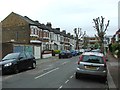
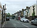
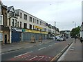
Photos of Green Street East Ward

Area Information
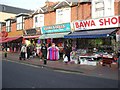
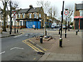
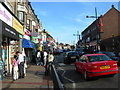
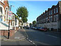
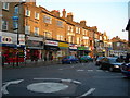
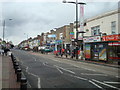
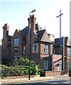
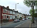
Green Street East Ward is an electoral ward within the London Borough of Newham, representing a distinct slice of cultural East London. Spanning 76.4 hectares, this district serves a population of approximately 2,100 residents. Located near the coordinates 51.53528°N and 0.03444°E, the ward sits at the boundary between the well-known districts of East Ham and West Ham. The area is urban in nature, characterised by a dense mix of shops, market outlets, and transport links. Historically significant, Green Street dates back to the late Iron Age or early Roman period, having become the official boundary between East and West Ham centuries ago. While the ward itself was established for elections in 2002, the streets around it have evolved significantly since the 19th century. Today, living in Green Street East Ward involves navigating a bustling neighbourhood defined by its diversity and proximity to major local landmarks. The area is closely associated with Upton Park and Forest Gate, positioning residents within a active corridor of London's heartland.
- Area Type
- District Borough Unitary Ward
- Area Size
- 76.4 hectares
- Population
- 2100
- Population Density
- 2750 people/km²
Demographics
The community profile within Green Street East Ward reflects a predominantly elderly resident base with a median age of 70 years. Despite this aging demographic, the broader Green Street corridor remains one of the most culturally diverse areas in the United Kingdom. In 2021, the combined Green Street wards recorded a total population of around 46,980. Specifically, Green Street East had 16,973 residents, with 8,564 males and 8,410 females. Ethnic diversity is pronounced, with the Asian population standing at 11,813, followed by White residents at 2,276 and Black residents at 1,781. A significant portion of the community, numbering 6,480 individuals, was born in the Middle East and Asia. Current housing data indicates that 41% of residents own their homes outright. This suggests a housing market navigating the needs of an older demographic alongside potential rental demand. The area does not specifically flag predominant religious or accommodation types in the available datasets, focusing instead on these clear housing and age statistics.
Household Size
Accommodation Type
Tenure
Ethnic Group
Religion
Household Composition
Age
Household Deprivation
NS-SEC
Explore more demographic insights in this area
Go to Demographics tabPlanning
Planning Constraints
- Flood RiskPremium
- Ramsar Wetland SitesPremium
- Area of Outstanding Natural BeautyPremium
- Protected Nature ReservePremium
- Protected WoodlandPremium
- Crime RiskPremium