Area Overview for Kensington and Chelsea
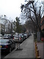
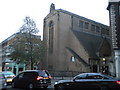
Photos of Kensington and Chelsea


Area Information
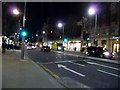
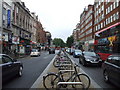
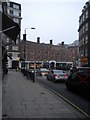
Kensington and Chelsea stands as a compact yet densely populated local authority district within England. The borough covers an area of just 11.1 km², yet it houses a population of 72,064 residents. This results in a population density of 6,504 people per square kilometre, making it one of the most crowded areas in the country. Living in Kensington and Chelsea means navigating a tightly built environment where space is at a premium. The sheer concentration of people within such a small geographical footprint defines the daily rhythm of life here. Every square inch is utilised, creating an urban landscape that is intense and efficient. Prospective homebuyers must appreciate that life in this district is characterised by high urbanisation. The district operates as a self-contained unitary authority, meaning it manages its own local services alongside national governance. You are entering a market where land value is derived from scarcity. The combination of small total area and a substantial population creates a specific dynamic for housing and living. It is a place where convenience often comes with a struggle for space. Understanding these fundamental statistics provides the only true context for considering homes in this region.
- Area Type
- Built Up Area 250
- Area Size
- 11.1 km²
- Population
- 72064
- Population Density
- 6504 people/km²
Amenities
Schools
| Rank | School | Type | Entry gender | Ages |
|---|
Explore more schools in this area
Go to Schools tabDemographics
The community profile of Kensington and Chelsea reflects a notably mature population. Data indicates that the median age of residents is 70 years old. This places the most common age range squarely within older demographics compared to other parts of the UK. Home ownership stands at 32%, meaning the vast majority of the population rents their accommodation. With only a third of households owning their property, living in Kensington and Chelsea is predominantly a rental experience. The district's household composition and predominant ethnic group and religious demographics are recorded as total, indicating comprehensive data availability for these broader categories. The demographic reality suggests an area where retirement and later-life living are central to the community feel. You are likely to find neighbours who are further down the life line. The low ownership percentage implies a dynamic where tenancy rules and landlord policies shape daily interactions. When evaluating schools near Kensington and Chelsea, the age profile suggests a lower pressure for primary education compared to family-heavy zones. Instead, the area serves a population seeking stability in different housing arrangements suitable for older occupants.
Household Size
Accommodation Type
Tenure
Ethnic Group
Religion
Household Composition
Age
Household Deprivation
NS-SEC
Explore more demographic insights in this area
Go to Demographics tabPlanning
Planning Constraints
- Crime RiskPremium