Area Overview for Hillingdon
Photos of Hillingdon


Area Information
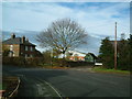
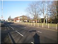
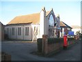
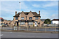
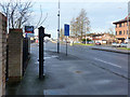
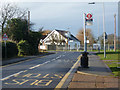
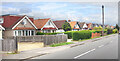
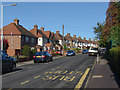
Living in the London Borough of Hillingdon offers a distinctive experience defined by its position as the westernmost perimeter of Greater London. This local authority district covers 73.2 square kilometres and forms a significant part of the historic county of Middlesex. Created on 1 April 1965 by amalgamating several former urban districts, the borough is now one of the largest London administrative areas. The population stands at 113,237 residents, creating a density of 1,547 people per square kilometre. Administrative headquarters are located at the Hillingdon Civic Centre in Uxbridge, which serves as the central hub for local governance. Daily life here balances historic character with modern connectivity. The area includes the market town of Uxbridge, which once served as an underground RAF Fighter Command bunker during the Battle of Britain. Residential life varies significantly between the north and south of the borough. The northern section remains largely green and spacious, a legacy of the Metropolitan Railway expansion into Metro-land in the early 1900s. Conversely, the southern area hosts Heathrow Airport, London's largest airport, opened in 1946, which drives local employment. This duality means you might encounter expansive parks and historic sites like Colne Valley Park alongside a workplace-focused economy. The region is home to 406 statutory listed buildings and 30 conservation areas, ensuring that any homes you purchase retain a strong sense of architectural heritage.
- Area Type
- Built Up Area 250
- Area Size
- 73.2 km²
- Population
- 113237
- Population Density
- 1547 people/km²
Amenities
Schools
| Rank | School | Type | Entry gender | Ages |
|---|
Explore more schools in this area
Go to Schools tabDemographics
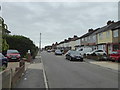
The community profile of Hillingdon reflects a settled, middle-aged population. The median age within this district is 70 years, indicating a significant number of older residents compared to the wider UK average. While specific data on the most common age range is recorded under total statistics, the high median age suggests a demographic skewed towards retirees and long-term residents. Understanding who lives here is vital for buyers considering schools near Hillingdon or active neighbourhoods. Home ownership rates stand at 58% of households, a figure that suggests a balanced market between buyers and renters. This level of ownership typically implies stability within the community. The borough accommodates various household compositions and accommodation types, though detailed breakdowns for these specific categories are not further detailed in current records. You will find a population that has grown steadily, particularly in the 1920s, with administrative changes absorbing surrounding parishes in 1965 to form the modern borough. The district incorporates several ancient parishes, including the market town of Uxbridge, which underwent rapid population growth before being incorporated into Uxbridge Urban District by 1929. For those looking at homes in Hillingdon, the demographic data points to an established community with a mature housing stock. The presence of historic properties, such as the Great Barn at Winchester College Farm built in 1426, resonates with residents who value tradition. With 113,237 people spread across the district, social services and community facilities remain a central focus. The low crime risk assessment further supports the idea that this is a stable environment. Families and individuals seeking a quiet, senior-friendly locale with strong community ties will find the local authority district suited to their needs.