Area Overview for Havering
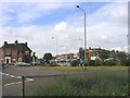
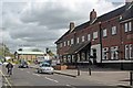
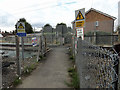
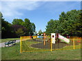
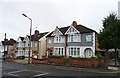
Photos of Havering


Area Information
Living in Havering offers a distinct experience for those seeking spacious grounds within easy reach of London. This local authority district covers 50.9 square kilometres, making it a relatively large urban area where residents have access to significant green spaces. With a population of 96,378 people, the borough strikes a balance between community living and the availability of individual household parcels, creating a less crowded feel than many inner-city counterparts. The area size allows for a variety of residential settings, though it remains a single administrative unit focused on local governance and services. The demographic centre of gravity skews noticeably older, which influences the pace of life and the character of neighbourhoods. You will find a settled community where daily routines are established and finances are generally stable. The population density of 1,894 people per square kilometre ensures that while the district is populated, it does not feel overcrowded compared to denser metropolitan zones. This spread supports a lifestyle where you can enjoy wide streets and open vistas between your home and local amenities. For anyone considering a move to this part of England, the primary appeal lies in the combination of generous living space and a manageable population count that sustains a quieter, more deliberate way of life. The community profile of Havering is defined largely by its residents' age and tenure status. The median age in the area stands at 70 years, indicating a population heavily weighted towards older adults. This age distribution shapes the local infrastructure and social activities available to you. Home ownership is the dominant form of residence, with 70% of households owning their property outright or with a mortgage. Such a high rate of ownership suggests a stable, long-term community where homeowners have invested significantly in their local environment. The remaining households in Havering are likely predominantly renting, but the balance leans firmly towards owner-occupation. The housing stock reflects this tenure structure, with many established dwellings suited to retired couples or older families. While specific breakdowns of household composition and accommodation types are recorded in the official totals, the prevailing figure of 70% ownership paints a clear picture of a settled neighbourhood. You can expect a demographic where residents prioritize stability and are often less inclined to move frequently. This profile creates a reliable environment for those joining the area later in life, as the surrounding residents share similar life stages and financial commitments. The property market in Havering is characterised by a substantial owner-occupier base, reflecting a mature housing landscape. With 70% of residents owning their homes, the borough presents an attractive option for buyers looking to join a neighbourhood of settled dwellers. This high ownership rate implies that the majority of houses in Havering are family-sized properties or suitable for older occupants, rather than short-term rental units. Accommodation types vary across the district, but the prevalence of ownership suggests a mix of established homes designed for long-term living. When you look at homes in Havering, you are entering a market where sellers are often seeking stability rather than quick turnover. This dynamic can influence pricing and transaction times, as owners may be more selective about buyers. The 30% rental portion of the market consists mostly of tenants who have chosen to live in Havering for specific reasons, possibly including proximity to family or the relative affordability of certain residential options within the borough. For you as a potential buyer, this environment offers a stable backdrop where property values tend to correlate with long-term maintenance and improvement. The local market is not driven by university students or mobile roughnecks, but by people seeking a permanent place to call home. Connectivity is excellent for the modern household living in Havering, with digital infrastructure meeting the demands of remote work and streaming. Fixed broadband scores 94 out of 100, ranking this area as having excellent internet speeds that support high-bandwidth activities without interruption. Mobile coverage is also robust, scoring 85 out of 100, which ensures you stay connected via smartphone whether you are at home or out in the neighbourhood. These connectivity levels mean that working from home is a viable and reliable option for many professionals in the district. The high-quality broadband score suggests that video conferencing, cloud storage, and large file transfers function smoothly for residents. For daily internet use, from streaming entertainment to managing online banking, the digital landscape in Havering provides a seamless experience. You do not need to worry about buffering issues when organizing virtual meetings or downloading movies. The mobile network quality complements home internet by offering reliable communication on the go. This strong digital foundation supports the lifestyle of the borough's 96,378 residents, ensuring that isolation due to poor connectivity is not a concern. Living in Havering grants you access to top-tier digital services that match the quality found in major metropolitan hubs. Safety in Havering is assured by a local crime risk assessment that places the district in the low-risk category. The safety score of 68 out of 100 indicates that crime rates here are below the national average, making it a secure choice for families and older residents alike. This assessment level suggests that you can move around your neighbourhood with confidence during evening hours or early mornings. The low crime risk is a significant factor for anyone prioritising peace of mind when choosing where to live. While this favourable rating applies broadly, it is important to remain aware that no area is entirely free of incident, but the overall probability of being a victim of crime is reduced compared to many other urban locations. The environment supports a sense of security that aligns with the older demographic profile of the 70-year median age resident. You will not face the daily anxieties associated with high-crime zones. Instead, the area offers a tranquil setting where safety is a consistent feature of daily life. This combination of a low crime risk and a stable community creates an ideal environment for those seeking a peaceful domestic life in England. What is the demographic makeup of people living in Havering?The population in Havering has a distinct median age of 70 years, reflecting a community dominated by older adults. This age profile contributes to a stable, settled environment where households are generally long-term residents. Approximately 70% of the 96,378 residents in this 50.9 square kilometre borough own their homes, reinforcing a culture of stability and deep local roots rather than a transient population. How reliable is internet connectivity for remote working in Havering?Digital infrastructure in Havering is highly capable for remote working and daily connectivity. Fixed broadband achieves an excellent score of 94 out of 100, ensuring fast speeds for video calls and large data transfers. Mobile coverage is also strong with an 85 out of 100 score, providing reliable network access throughout the borough. These figures confirm that you can work from home effectively without technical disruption. Is Havering considered a safe area for residents and families?Havering has a low crime risk classification, evidenced by a safety score of 68 out of 100. This score indicates that crime rates are below the national average, creating a secure environment for homebuyers. The low incidence of crime aligns well with the area's older demographic and supports a peaceful daily life free from the anxieties associated with high-crime zones. What percentage of homes in Havering are owner-occupied?The property market in Havering is heavily weighted towards owner-occupation, with 70% of households owning their homes. This high percentage indicates a stable community where residents have invested in their properties for the long term. The remaining 30% are likely rented, but the overwhelming majority are homeowners who form the backbone of the local community.
- Area Type
- Built Up Area 250
- Area Size
- 50.9 km²
- Population
- 96378
- Population Density
- 1894 people/km²
Amenities
Schools
| Rank | School | Type | Entry gender | Ages |
|---|
Explore more schools in this area
Go to Schools tabDemographics
The community profile of Havering is defined largely by its residents' age and tenure status. The median age in the area stands at 70 years, indicating a population heavily weighted towards older adults. This age distribution shapes the local infrastructure and social activities available to you. Home ownership is the dominant form of residence, with 70% of households owning their property outright or with a mortgage. Such a high rate of ownership suggests a stable, long-term community where homeowners have invested significantly in their local environment. The remaining households in Havering are likely predominantly renting, but the balance leans firmly towards owner-occupation. The housing stock reflects this tenure structure, with many established dwellings suited to retired couples or older families. While specific breakdowns of household composition and accommodation types are recorded in the official totals, the prevailing figure of 70% ownership paints a clear picture of a settled neighbourhood. You can expect a demographic where residents prioritize stability and are often less inclined to move frequently. This profile creates a reliable environment for those joining the area later in life, as the surrounding residents share similar life stages and financial commitments. The property market in Havering is characterised by a substantial owner-occupier base, reflecting a mature housing landscape. With 70% of residents owning their homes, the borough presents an attractive option for buyers looking to join a neighbourhood of settled dwellers. This high ownership rate implies that the majority of houses in Havering are family-sized properties or suitable for older occupants, rather than short-term rental units. Accommodation types vary across the district, but the prevalence of ownership suggests a mix of established homes designed for long-term living. When you look at homes in Havering, you are entering a market where sellers are often seeking stability rather than quick turnover. This dynamic can influence pricing and transaction times, as owners may be more selective about buyers. The 30% rental portion of the market consists mostly of tenants who have chosen to live in Havering for specific reasons, possibly including proximity to family or the relative affordability of certain residential options within the borough. For you as a potential buyer, this environment offers a stable backdrop where property values tend to correlate with long-term maintenance and improvement. The local market is not driven by university students or mobile roughnecks, but by people seeking a permanent place to call home. Connectivity is excellent for the modern household living in Havering, with digital infrastructure meeting the demands of remote work and streaming. Fixed broadband scores 94 out of 100, ranking this area as having excellent internet speeds that support high-bandwidth activities without interruption. Mobile coverage is also robust, scoring 85 out of 100, which ensures you stay connected via smartphone whether you are at home or out in the neighbourhood. These connectivity levels mean that working from home is a viable and reliable option for many professionals in the district. The high-quality broadband score suggests that video conferencing, cloud storage, and large file transfers function smoothly for residents. For daily internet use, from streaming entertainment to managing online banking, the digital landscape in Havering provides a seamless experience. You do not need to worry about buffering issues when organizing virtual meetings or downloading movies. The mobile network quality complements home internet by offering reliable communication on the go. This strong digital foundation supports the lifestyle of the borough's 96,378 residents, ensuring that isolation due to poor connectivity is not a concern. Living in Havering grants you access to top-tier digital services that match the quality found in major metropolitan hubs. Safety in Havering is assured by a local crime risk assessment that places the district in the low-risk category. The safety score of 68 out of 100 indicates that crime rates here are below the national average, making it a secure choice for families and older residents alike. This assessment level suggests that you can move around your neighbourhood with confidence during evening hours or early mornings. The low crime risk is a significant factor for anyone prioritising peace of mind when choosing where to live. While this favourable rating applies broadly, it is important to remain aware that no area is entirely free of incident, but the overall probability of being a victim of crime is reduced compared to many other urban locations. The environment supports a sense of security that aligns with the older demographic profile of the 70-year median age resident. You will not face the daily anxieties associated with high-crime zones. Instead, the area offers a tranquil setting where safety is a consistent feature of daily life. This combination of a low crime risk and a stable community creates an ideal environment for those seeking a peaceful domestic life in England. What is the demographic makeup of people living in Havering?The population in Havering has a distinct median age of 70 years, reflecting a community dominated by older adults. This age profile contributes to a stable, settled environment where households are generally long-term residents. Approximately 70% of the 96,378 residents in this 50.9 square kilometre borough own their homes, reinforcing a culture of stability and deep local roots rather than a transient population. How reliable is internet connectivity for remote working in Havering?Digital infrastructure in Havering is highly capable for remote working and daily connectivity. Fixed broadband achieves an excellent score of 94 out of 100, ensuring fast speeds for video calls and large data transfers. Mobile coverage is also strong with an 85 out of 100 score, providing reliable network access throughout the borough. These figures confirm that you can work from home effectively without technical disruption. Is Havering considered a safe area for residents and families?Havering has a low crime risk classification, evidenced by a safety score of 68 out of 100. This score indicates that crime rates are below the national average, creating a secure environment for homebuyers. The low incidence of crime aligns well with the area's older demographic and supports a peaceful daily life free from the anxieties associated with high-crime zones. What percentage of homes in Havering are owner-occupied?The property market in Havering is heavily weighted towards owner-occupation, with 70% of households owning their homes. This high percentage indicates a stable community where residents have invested in their properties for the long term. The remaining 30% are likely rented, but the overwhelming majority are homeowners who form the backbone of the local community.