Area Overview for Hammersmith and Fulham
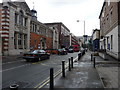
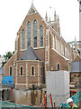
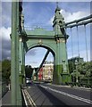
Photos of Hammersmith and Fulham


Area Information
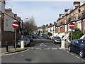
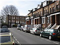
Hammersmith and Fulham is a built-up area in England covering 14.2 km². This relatively small footprint supports a population of 110,538 people, resulting in a high population density of 7,784 people per square kilometre. Living in Hammersmith and Fulham means navigating a tightly packed urban environment where residents share space efficiently. The area functions as a major part of South West London, blending residential zones with significant transport hubs. Daily life here is defined by proximity to key thoroughfares and the rapid flow of people through its districts. You will encounter a Victorian street grid interspersed with modern commercial developments. The high density ensures that essential services are rarely far from your doorstep. This compact size distinguishes the locality from more sprawling suburban towns. Homebuyers choosing to live in Hammersmith and Fulham accept a dynamic urban rhythm in exchange for central access and available amenities. The area serves as a critical node connecting residential pockets to the wider London transport network.
- Area Type
- Built Up Area 250
- Area Size
- 14.2 km²
- Population
- 110538
- Population Density
- 7784 people/km²
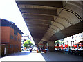
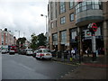
Lifestyle in Hammersmith and Fulham revolves around a dense network of retail and transport amenities. You have immediate access to five retail locations, including M&S Hammersmith Flyover BP, Tesco Hammersmith, and M&S Hammersmith. These shops provide daily necessities and shopping opportunities within a short walk. Transport links are equally extensive with five Metro stations offering direct links to central London. The rail network is supported by five stations, ensuring connections via Kensington Station and Shepherd’s Bush Railway Station. Five ferry points serve the riverside communities, including Putney Pier and Wandsworth Riverside Quarter Pier. Local bus services connect to major hubs like London Victoria Coach Station and Green Line Coach Station. Living in Hammersmith and Fulham means you are never far from a shop or a station. The concentration of M&S locations and major retailers indicates a well-stocked commercial environment. Daily errands require minimal travel time in this built-up zone. The area supports a lifestyle where leisure, work, and shopping coexist in close proximity.
Amenities
Schools
Families considering Hammersmith and Fulham have access to a specific range of early years education providers within the locality. The area hosts several nurseries that serve as the first educational step for young children. Marshcroft Early Years Centre is available to families in the district. Horder Nursery School operates within the local network of early education. Randolph Beresford Early Years Centre offers nursery facilities for young residents. Vanessa Nursery School provides another option for early childhood learning. James Lee Nursery School completes the list of identified nursery provisions. These institutions are all classified specifically as nurseries and do not fall under the primary or secondary school categories in the current data. The presence of multiple nurseries suggests a demand for childcare among the younger segments of the population. If your priority is early years education, the choices in Hammersmith and Fulham are concentrated at the nursery level. The data does not list primary or secondary schools, indicating that the local borough manages extensive school networks, but these specific facilities are confirmed. You must verify為主 secondary education options with the Council directly if that is your primary concern.
| Rank | School | Type | Entry gender | Ages |
|---|
Explore more schools in this area
Go to Schools tabDemographics
The community in Hammersmith and Fulham presents a distinct demographic profile characterised by an older population. Residents have a median age of 70 years, indicating that the area attracts those in retirement or settling down. Most residents fall into the 'Age: Total' category, reflecting the established nature of the neighbourhood rather than young families. Home ownership rates stand at 34%, meaning a significant majority of households rent their properties. This figure suggests a landscape dominated by private landlords and corporate lettings rather than owner-occupied families. The area accommodates a total count of households and accommodation types typical of high-density London boroughs. While specific data on household composition breaks down isn't detailed, the low ownership rate points to a significant tenant population. This demographic structure influences local spending habits, community groups, and the types of services required. Living in Hammersmith and Fulham involves engaging with a community where long-term tenancies are common alongside professional and retired residents. The low proportion of owner-occupiers shapes the social dynamics and investment landscape of the neighbourhood.
Household Size
Accommodation Type
Tenure
Ethnic Group
Religion
Household Composition
Age
Household Deprivation
NS-SEC
Explore more demographic insights in this area
Go to Demographics tabPlanning
Planning Constraints
- Crime RiskPremium