Area Overview for Camden
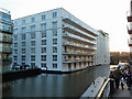
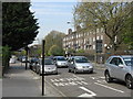
Photos of Camden


Area Information
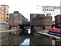
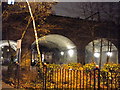
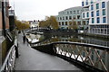
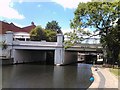
Living in Camden means residing within a large built-up urban district that spans 18.3 square kilometres. This dense London borough, located just 2.3 kilometres north of Charing Cross, was formed in 1965 through the merger of Hampstead, Holborn, and St Pancras. Today, approximately 129,805 people call this area home, resulting in a high population density of 7,109 residents per square kilometre. The borough stretches from the properties under High Holborn to the northern reaches near Hampstead Heath. You will find a mix of urban living influenced by its industrial past and significant immigrant communities. Historical landmarks define the streets, including Regent's Canal and extensive blue plaques marking the homes of once-famous residents. While the area retains sections of Hampstead with Victorian and Edwardian architecture, the overarching character is that of a crowded, mixed-purpose inner London neighbourhood. Daily life here revolves around proximity to major transport hubs like Euston and St Pancras International, which facilitate travel across the UK and to Europe. The borough is defined by its conservation areas, listed buildings, and a history of hosting diverse ethnic groups. For anyone considering this location, expect an environment rich in art history and cultural landmarks rather than quiet suburban streets.
- Area Type
- Built Up Area 250
- Area Size
- 18.3 km²
- Population
- 129805
- Population Density
- 7109 people/km²
Daily life in Camden offers a wide array of amenities within practical reach of your doorstep. Residents have immediate access to five retail outlets, including Tesco Chalk, Amazon Fresh, and Sainsburys Chalk, ensuring your shopping needs are covered. Cultural and leisure options are equally diverse, with five metro stations acting as hubs; Chalk Farm and Camden Town stations are particularly key for exploring the high street and markets. The borough integrates transport and lifestyle seamlessly, offering five ferry stops such as the Camden Lock Waterbus and London Zoo Waterbus Stop, which connect you to riverside paths and attractions. You can also utilise the rail network through five major stations to access nearby rail and coach links, including the Green Line Coach Station. These facilities create a convenient environment where you can walk to work, shop for groceries, or explore transport-linked leisure spots. The presence of multiple stop types, from buses to waterbuses, highlights the area's connectivity. Living here means you stay close to your transport needs without relying solely on your private vehicle. The density of amenities reflects the high population concentration, making it a self-contained environment capable of meeting most daily demands.
Amenities
Schools
Families residing in Camden must navigate a selection of educational facilities based on the schools listed within your local vicinity. Argyle Primary School stands out as a key option for younger children, holding a good Ofsted rating. You also have access to Sherborne Nursery School and Thomas Coram Centre, both classified as nurseries for pre-school needs. Supporting the broader educational landscape are establishments like Heath School and the Camden Primary Pupil Referral Unit, which serve alternative or specialist learning requirements. Finding comprehensive or independent schools near this specific postcode is not possible using the provided school list, limiting your choices to the primary and special needs sector outlined above. The presence of a primary pupil referral unit indicates support systems are available for students who require a different educational approach than mainstream provision. If you are looking for excellent primary education in the immediate area, Argyle Primary School offers a verified standard of quality. For early years, the availability of two nurseries suggests multiple choices for childcare. You should note that the data does not list secondary schools, so further research is required to find high schools for older children living on the periphery of this borough.
| Rank | School | Type | Entry gender | Ages |
|---|
Explore more schools in this area
Go to Schools tabDemographics
You will find that the community in Camden reflects a specific age profile and household structure. The median age in this borough stands at 70, indicating a significant proportion of older residents within the total population. Ownership records show that 30% of people owning or buying their homes hold title to their property in this area. This figure implies that the remaining 70% live in the private rented sector or other non-ownership arrangements, suggesting a market heavily influenced by renting. The demographic data lists total household composition and accommodation type as primary categories, but specific breakdowns for these groups are not detailed in the available records. Similarly, while the area has hosted Greek, Irish, Italian, German, and Cypriot communities historically, current predominant ethnic group and religion statistics are not provided. You can expect a crowded environment where the high population density creates a shared urban experience. The older median age combined with high density suggests a neighbourhood that may cater to retirees, long-term residents, and institutional tenants. Without specific data on deprivation levels, you must rely on general feedback about the intensity of living in such a small geographical footprint. The community feel is shaped by these population figures rather than clear-cut family demographics.
Household Size
Accommodation Type
Tenure
Ethnic Group
Religion
Household Composition
Age
Household Deprivation
NS-SEC
Explore more demographic insights in this area
Go to Demographics tabPlanning
Planning Constraints
- Crime RiskPremium