Area Overview for Barnet
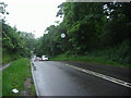
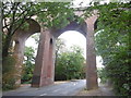
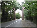
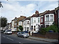
Photos of Barnet


Area Information
Living in Barnet offers a distinct experience within a built-up area spanning 65.4 km². The local population stands at 226,892 people, creating a community with a significant size that feels established yet manageable. You will find plenty of space for daily activities across this London Borough of Barnet, where the density of residents averages 3,468 people per square kilometre. This figure suggests a balanced environment without being cramped or overly sparse. The area functions as a major residential zone with clear boundaries and defined neighbourhoods. Prospective buyers often appreciate the scale of Barnet, which allows for a mix of housing styles within a cohesive framework. Every eighth kilometre contains roughly 3,500 residents, indicating a moderate spread of households. This siting provides a backdrop for a steady local economy and social fabric. When you consider homes in Barnet, you are choosing a settlement with a long history of growth. The size of the land and number of inhabitants work together to support local services and amenities. You can expect a familiar rhythm to life here, characterised by reliability and stability.
- Area Type
- Built Up Area 250
- Area Size
- 65.4 km²
- Population
- 226892
- Population Density
- 3468 people/km²
Daily life in Barnet benefits from a practical network of retail, rail, metro, and water bus connections. You can shop at Co-op Barnet, Waitrose Mill, and M&S Kellys Corner BP for your essential household needs. These retailers provide easy access to groceries and daily items without lengthy travel. Public transport opportunities include Mill Hill East Station, West Finchley Station, and Finchley Central Station for metro travel. Rail links via Mill Hill Broadway, Oakleigh Park Station, and Hendon Station further extend your reach across the region. If you enjoy water transport, Camden Lock Waterbus and London Zoo Waterbus Stop offer alternative routes close to the area. This variety means you have multiple ways to commute or go out depending on your mood. The presence of these specific venues ensures that convenience is a feature of your routine. Shopping, commuting, and leisure activities are all within practical reach for residents of Barnet.
Amenities
Schools
Families in Barnet have access to a selection of nurseries and educational centres within the local vicinity. You can explore attendance options at Brookhill Nursery School, which serves the youngest students in the catchment area. Nearby, Hampden Way Nursery School offers similar early years education for young children living close by. Moss Hall Nursery School provides another dedicated space for preschool education and development. St Margaret's Nursery School completes the list of available nursery facilities for residents seeking early childhood care. For older children, the data highlights the Pavilion Study Centre as a notable educational venue. This institution serves a broader audience beyond primary age groups. The presence of these specific schools indicates a functional network for early learning and study. When evaluating schools near Barnet, you will see a range of options focused on foundational education. The mix includes both traditional nursery settings and alternative study centres, offering different approaches to learning.
| Rank | School | Type | Entry gender | Ages |
|---|
Explore more schools in this area
Go to Schools tabDemographics
The community composition in Barnet reflects a mature demographic profile. The median age for residents is 70 years, which indicates a presence of many older households settling in the borough. This statistic shapes the local needs, from service provision to social engagement. You will encounter a population where age is the primary defining factor, with the total age range representing the bulk of the census data. Home ownership plays a central role in daily life, with 54 per cent of residents owning their properties outright or with a mortgage. This majority ownership rate suggests a stable community where long-term investment in property is common. The household composition data shows that families and single-person households coexist within the broader total population fabric. Accommodation types vary across the borough, though the total count reflects the standard housing stock available for these demographics. Diversity in the area contributes to the social texture, even if specific ethnic group breakdowns are not detailed in current reports. Religion data follows the same pattern, reflecting the broad faith landscape of the UK without isolating single dominant groups. Understanding these figures helps you gauge the social environment when thinking about living in Barnet.