Area Overview for Golders Green Ward
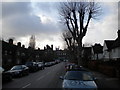
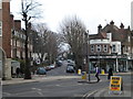
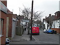
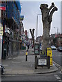
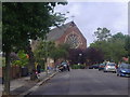
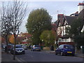
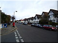
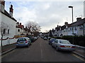
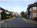
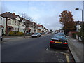
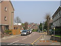
Photos of Golders Green Ward

Area Information
Golders Green Ward sits within the London Borough of Barnet, occupying a compact 1.6 km² area approximately 5.6 miles northwest of Charing Cross. This suburban district, centred on the commercial intersection of Golders Green Road and Finchley Road, has evolved from a medieval hamlet into a established residential zone. You will find a neighbourhood deeply rooted in history, having originated in the parish of Hendon before experiencing rapid expansion in the late 19th and early 20th centuries. The area developed significantly following the opening of Golders Green Underground station in 1907, which transformed the local footprint and supported population growth to current levels of around 1,785 residents. Daily life here is defined by its location on a key transport corridor, connecting you to the wider city while maintaining a distinct suburban character. The ward houses notable landmarks including Golders Hill Park, acquired in 1898, and the historic Golders Green Hippodrome. Whether you are interested in living in Golders Green Ward or exploring homes in this specific ward, the area offers a blend of commercial activity on the main road and established residential streets that reflect its development over the last century.
- Area Type
- District Borough Unitary Ward
- Area Size
- 1.6 km²
- Population
- 1785
- Population Density
- 1087 people/km²
Demographics
The community profile of Golders Green Ward reveals an area with an unusually high median age of 70 years. This demographic skew suggests the ward is dominated by residents in their late retirement years. With a total population of 1,785 people across just 1.6 km², the area achieves a population density of 1,087 people per square kilometre. This density indicates a reasonably compact living environment but reinforces the dominance of an older demographic cohort. Regarding housing tenure, approximately 48% of residents own their homes outright, meaning nearly half the population enjoys the security of owner-occupation without the burden of a mortgage. The remaining residents likely reside in privately rented properties or through local authority schemes, though specific breakdowns for these categories are not detailed in current records. The higher-than-average age profile means you will encounter fewer young families in this specific electoral boundary compared to other parts of Barnet or North London. Understanding that the most common population group falls into the total age bracket is crucial for prospective buyers expecting a bachelorette or young family demographic, as the data suggests a very mature neighbourhood structure.
Household Size
Accommodation Type
Tenure
Ethnic Group
Religion
Household Composition
Age
Household Deprivation
NS-SEC
Explore more demographic insights in this area
Go to Demographics tabPlanning
Planning Constraints
- Flood RiskPremium
- Ramsar Wetland SitesPremium
- Area of Outstanding Natural BeautyPremium
- Protected Nature ReservePremium
- Protected WoodlandPremium
- Crime RiskPremium