Area Overview for Fulham Reach Ward
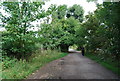
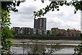
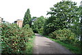
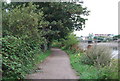
Photos of Fulham Reach Ward

Area Information
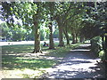
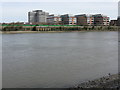
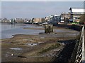
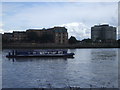
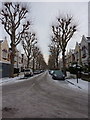
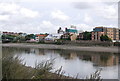
Fulham Reach Ward sits along the northern bank of the River Thames within the London Borough of Hammersmith and Fulham. This electoral ward covers an area of 91.4 hectares and offers a distinctively waterfront location in Greater London. The position at approximately 51.4845°N, 0.2183°W places the ward directly adjacent to the river, influencing the character of the land and the homes within it. Living here means experiencing a specific pocket of London defined by its proximity to the river rather than dense urban sprawl. The ward functions as a significant local unit within the borough's administrative structure. Prospective buyers looking at homes in Fulham Reach Ward should note the physical footprint of the area and its geographical constraints defined by the river boundary. Daily life in this ward is shaped by its riverine setting and its role as a local administrative centre for a defined population. The area does not offer the statistical depth of larger districts, yet it maintains a clear identity based on its unique location. Residents of Fulham Reach Ward engage with a specific environment that differs from surrounding wards due to these geographical features. Understanding this location requires looking at the ward boundaries and the specific streets that define the local network.
- Area Type
- District Borough Unitary Ward
- Area Size
- 91.4 hectares
- Population
- Not available
- Population Density
- Not available
Demographics
The community in Fulham Reach Ward displays a static population profile with a distinct lack of recent demographic data in the public records. A median age of 70 indicates that the residents here are significantly older than the national average. Most people fall into the 'Total' age category classification, suggesting a broad distribution without a concentrated youth cohort. Home ownership stands at 37%, meaning the majority of residents do not own their properties outright. This low ownership figure suggests a strong rental market or tenancy arrangements dominate the social fabric. Household composition data is recorded only as 'total', preventing a breakdown of single-person households versus families. Accommodation type details are similarly generalised under 'total', obscuring the specific mix of terraced houses, flats, or detached properties. Diversity metrics are listed as 'total', offering no insight into the predominant ethnic group or religious makeup of the neighbourhood. You should approach expectations regarding family demographics with caution given these broad classifications. The age profile suggests a quieter, perhaps slower-paced environment where many individuals live beyond the typical retirement years. Homebuyers must accept that specific details on household structures are aggregated into general categories. The ward presents a community where older demographics live alongside others in a setting defined by these broad statistical groupings.
Household Size
Accommodation Type
Tenure
Ethnic Group
Religion
Household Composition
Age
Household Deprivation
NS-SEC
Explore more demographic insights in this area
Go to Demographics tabPlanning
Planning Constraints
- Flood RiskPremium
- Ramsar Wetland SitesPremium
- Area of Outstanding Natural BeautyPremium
- Protected Nature ReservePremium
- Protected WoodlandPremium
- Crime RiskPremium