Area Overview for Feltham West Ward
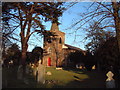
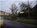
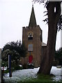
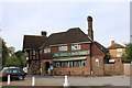
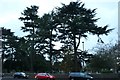
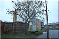
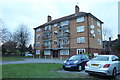
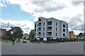
Photos of Feltham West Ward
Area Information
Feltham West Ward is a distinct electoral ward situated within the London Borough of Hounslow in west London. It forms part of the larger Feltham and Heston parliamentary constituency and operates under a specific set of boundaries. The area covers a total land surface of 3.2 km², which results in a population density of 1016 people per square kilometre. This compact footprint supports a community of 3234 residents, creating a relatively close-knit environment compared to the wider borough. The ward elects three councillors to represent local interests, ensuring governance remains tied to this specific geographical zone. Living in Feltham West Ward means engaging with a locality that balances residential needs within a precisely defined administrative area. The population figure of 3234 reflects the censused inhabitants recorded for this specific ward as of the latest available data. Prospective buyers should note that the ward is measured by these clear metrics of size and population. You purchase a home in an area where the scale is manageable, with clear boundaries defining the community limits. The location serves as a defined unit within the broader London landscape, offering a specific neighbourhood identity for those seeking residence here.
- Area Type
- District Borough Unitary Ward
- Area Size
- 3.2 km²
- Population
- 3234
- Population Density
- 1016 people/km²
Demographics
The character of Feltham West Ward is defined by an exceptionally elderly population profile. The median age for residents sits at 70 years, indicating that the community consists primarily of older adults in their retirement years. This demographic reality influences the daily rhythm of the neighbourhood significantly compared to other parts of London. Home ownership levels are moderate, with 48% of households owning their property outright or with a mortgage. This figure suggests that nearly half of the 3234 residents do not own their homes, while the other half remain tenants or live arrangements typical of the rental sector. The ward lacks specific data on predominant ethnic groups or religious affiliations in the provided statistics, meaning these aspects remain undefined in current records. Household composition details are not broken down in the available figures, leaving the specific family structures of the 48% homeowners and the remaining tenants unclear. Despite these gaps, the age profile creates a distinct social environment. The high median age suggests a community accustomed to slower-paced living and potentially higher demand for senior-friendly services. You can expect a population where older generations form the majority, shaping the local culture and social interactions in ways much younger wards do not.
Household Size
Accommodation Type
Tenure
Ethnic Group
Religion
Household Composition
Age
Household Deprivation
NS-SEC
Explore more demographic insights in this area
Go to Demographics tabPlanning
Planning Constraints
- Flood RiskPremium
- Ramsar Wetland SitesPremium
- Area of Outstanding Natural BeautyPremium
- Protected Nature ReservePremium
- Protected WoodlandPremium
- Crime RiskPremium