Area Overview for Farringdon Without Ward
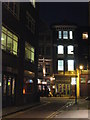
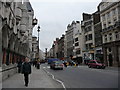
Photos of Farringdon Without Ward
Area Information
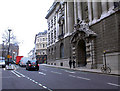
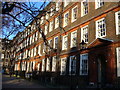
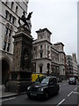
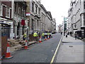
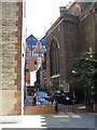
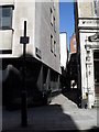
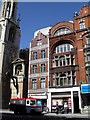
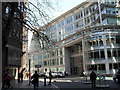
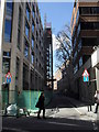
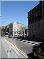
Farringdon Without Ward stands as a historic district within the City of London, covering an area of 33.0 hectares. This ward lies just west of Farringdon Within Ward and Aldersgate Ward, positioned distinctly outside the ancient city walls. The designation "Without" marks its location beyond the medieval boundaries of Newgate and Ludgate, separating it from the core enclosed area. You are stepping into a place shaped by William Faringdon, the principal owner of the original greater ward, before Parliament split it in the reign of Richard II. Three ancient east-west thoroughfares connect this ward to Westminster, Whitehall, and the West End, guiding your daily movement through a landscape defined by history. The north-south axis follows the path of the River Fleet, now largely hidden beneath modern Farringdon Street. Living here means navigating an environment built around significant institutions, including the Temple Church founded by the Knights Templar and the former site of the Priory of Whitefriars. You find yourself in the historic centre of London's legal sector, surrounded by the Inner and Middle Temples. Daily life is anchored by centuries-old courts and passages like Exchequer Court, Tanfield Court, and Cloisters Court, which still frame the streetscape.
- Area Type
- District Borough Unitary Ward
- Area Size
- 33.0 hectares
- Population
- Not available
- Population Density
- Not available
Demographics
Living in Farringdon Without Ward places you within an area defined by its profound historical roots rather than modern demographic statistics. The ward does not provide population figures, age profiles, or household type breakdowns in the available records. You cannot determine the specific age range of residents or the prevalence of single-person versus family households from the current data. Ownership levels and diversity metrics are absent from the provided information, so you must rely on the physical and institutional character of the area to understand the community. The ward contains two of the Inns of Court, the Inner and Middle Temples, which serve as the centre of the legal sector. These institutions house barristers and legal professionals who occupy the historic courts and residential spaces that define the neighbourhood. While specific numbers on who lives here are not included, the presence of the Rolls Building, the Commercial Court, and tribunals indicates a professional population drawn to the area. You are buying into a district where the primary residents have long been or currently are the legal community and their staff. The historical suppression of pretended privileged places under William III also shaped the social structure of the ward.
Household Size
Accommodation Type
Tenure
Ethnic Group
Religion
Household Composition
Age
Household Deprivation
NS-SEC
Explore more demographic insights in this area
Go to Demographics tabPlanning
Planning Constraints
- Flood RiskPremium
- Ramsar Wetland SitesPremium
- Area of Outstanding Natural BeautyPremium
- Protected Nature ReservePremium
- Protected WoodlandPremium
- Crime RiskPremium