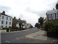
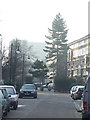
Area Overview for Faraday Ward
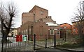
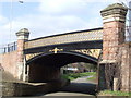
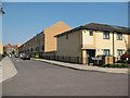
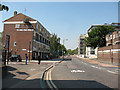
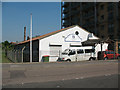
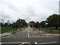
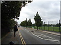
Photos of Faraday Ward


Area Information
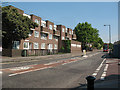
Living in Faraday Ward offers a defined urban experience within the London Borough of Southwark. This electoral ward covers a compact area of only 1.1 km² yet holds a population of 5,546 residents. The density stands at 5,034 people per square kilometre, which gives daily life a concentrated, central London feel. You will find yourself situated near the Walworth neighbourhood, with coordinates placing the ward approximately 51.48° N and 0.09° W. The area sits south-east of Charing Cross and borders significant housing developments such as the Aylesbury Estate and East Walworth. Historical boundaries have shifted multiple times since the ward's creation in 1965, including a major transfer of land from Lambeth in 1993. Notable local landmarks include Aycliffe House, a historic apartment building known as Attached Railings, and the former Heygate Estate, which stood until its demolition between 2011 and 2014. Lime Kiln within Burgess Park is another historic feature nearby. Prospective buyers who want to understand the scale and history of this Southwark district will find Faraday Ward to be a distinct, compact entity shaped by decades of urban planning and boundary revisions.
- Area Type
- District Borough Unitary Ward
- Area Size
- 1.1 km²
- Population
- 5546
- Population Density
- 5034 people/km²
Demographics
The community in Faraday Ward has a distinct age profile, centred around a median age of 70. This indicates an older resident population compared to many other parts of the country. The demographic mix is heavily weighted toward this older age group, shaping the social needs and daily rhythms of the ward. Only 17% of homes in the area are owner-occupied, which is a markedly low figure for London. This statistic signals that the vast majority of residents rely on the private rental market rather than owning their property. The data does not specify the breakdown of household composition or ethnic diversity percentages, but the dominance of renting and the older population define the current social fabric. With a population density exceeding 5,000 people per square kilometre, the area supports a large number of households in a small footprint. You should anticipate a community where rental agreements are common and where the average resident is likely well into retirement age. The accommodation types are not individually detailed in the available records, but the overall ownership rate strongly suggests a landscape dominated by assured shorthold tenancies or long-assured tenancies typical of Southwark. Understanding these demographics helps you gauge the neighbours and the pace of community life in this Southwark ward.
Household Size
Accommodation Type
Tenure
Ethnic Group
Religion
Household Composition
Age
Household Deprivation
NS-SEC
Explore more demographic insights in this area
Go to Demographics tabPlanning
Planning Constraints
- Flood RiskPremium
- Ramsar Wetland SitesPremium
- Area of Outstanding Natural BeautyPremium
- Protected Nature ReservePremium
- Protected WoodlandPremium
- Crime RiskPremium