Area Overview for Evelyn Ward
Photos of Evelyn Ward

Area Information
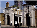
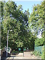
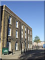
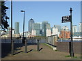
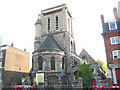
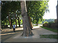
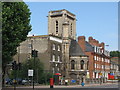
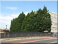
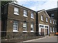
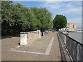
Evelyn Ward sits in the northern corner of the London Borough of Lewisham, forming a distinct district along the south bank of the River Thames. This makes it the only ward within Lewisham to border the river directly. The area occupies a compact footprint of 1.3 km² yet supports a population of 3,543 people. You live on the edge of Deptford, sharing a southern border with the New Cross ward. Its name honours John Evelyn, who owned Sayes Court on the site from 1653 until 1693 before moving to Surrey. The landscape features historical green spaces rather than modern high-rise development. Sayes Court Park, originally John Evelyn’s gardens, sits alongside Deptford Park, which opened in 1897 on former family market grounds. Residents also access Pepys Park, a 1960s estate built on the former Royal Victoria Victualling Yard. This site retains historic structures, including a 1788 gateway, a 1768 colonnade, and 1780 rum warehouses. Living in Evelyn Ward means walking through old maritime history and established parks while relying on the urban sprawl of south-east London. The ward sits at coordinates 51.4874° N, -0.0347° W, marking its precise location in the southern reaches of the capital.
- Area Type
- District Borough Unitary Ward
- Area Size
- 1.3 km²
- Population
- 3543
- Population Density
- 2719 people/km²
Demographics
The community in Evelyn Ward has an older demographic profile compared to many parts of south-east London. The median age for residents stands at 70 years, indicating a neighbourhood with a significant retiree population. Most households consist of adults raising children, yet the age data suggests a strong presence of older age groups influencing daily life. You will find that 28% of local households own their homes outright or have a mortgage, while the remaining 72% are likely renting. The ward does not specify the predominant ethnic group or religious breakdown in the available records. Accommodation types and specific household compositions are listed as totals, meaning the mix of family homes and single-person households varies widely. Despite the lack of specific diversity statistics, the area functions as part of a larger inner-London labour force where people commute from various backgrounds. The population density reaches 2,719 people per square kilometre, reflecting a tight-knit urban environment living within the 1.3 km² boundary. This density supports a high-volume neighbourhood where services must cater to a broad, age-varied group without relying on specific sub-group data.
Household Size
Accommodation Type
Tenure
Ethnic Group
Religion
Household Composition
Age
Household Deprivation
NS-SEC
Explore more demographic insights in this area
Go to Demographics tabPlanning
Planning Constraints
- Flood RiskPremium
- Ramsar Wetland SitesPremium
- Area of Outstanding Natural BeautyPremium
- Protected Nature ReservePremium
- Protected WoodlandPremium