Area Overview for EN8 8HT
Photos of EN8 8HT

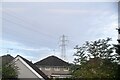
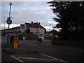
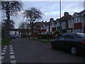
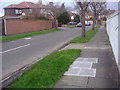
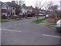

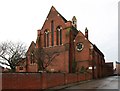
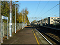

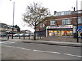
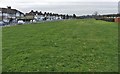
16 photos from this area
Area Information
Key information about the EN8 8HT including its size, population, and administrative classification.
- Area Type
- Postcode
- Area Size
- 3.6 hectares
- Population
- 1794
- Population Density
- 5861 people/km²
House Prices in EN8 8HT
14
Properties
£299,650
Average Sold Price
£79,800
Lowest Price
£450,000
Highest Price
Showing 14 properties
| Address | Type | Beds | Baths | Last Sale Price | Last Sale Date | |
|---|---|---|---|---|---|---|
| 40 Bullsmoor Way, Enfield, EN8 8HT | house | - | - | £450,000 | Feb 2023 | |
| 36 Bullsmoor Way, Enfield, EN8 8HT | Terraced | 3 | 1 | £420,000 | Sep 2020 | |
| 46-48 Bullsmoor Way, Enfield, EN8 8HT | house | - | - | £400,000 | Dec 2019 | |
| 52 Bullsmoor Way, Enfield, EN8 8HT | Terraced | 3 | - | £393,000 | Oct 2016 | |
| 54 Bullsmoor Way, Enfield, EN8 8HT | Terraced | 3 | 1 | £325,000 | Aug 2015 | |
| 50 Bullsmoor Way, Enfield, EN8 8HT | Terraced | 3 | - | £325,000 | Jun 2014 | |
| 38 Bullsmoor Way, Enfield, EN8 8HT | house | 3 | - | £256,000 | Jun 2013 | |
| 48 Bullsmoor Way, Enfield, EN8 8HT | Detached | - | - | £236,000 | Jul 2009 | |
| 34 Bullsmoor Way, Enfield, EN8 8HT | house | - | - | £273,000 | Feb 2008 | |
| 44 Bullsmoor Way, Enfield, EN8 8HT | Terraced | - | - | £229,995 | Mar 2005 |
Page 1 of 2
Energy Efficiency in EN8 8HT
Amenities
Schools
| Rank | School | Type | Entry gender | Ages |
|---|
Explore more schools in this area
Go to Schools tabDemographics
Household Size
Family (3-5 people)
most common
Accommodation Type
Houses
most common
Tenure
40
majority
Ethnic Group
White
most common
Religion
N/A
most common
Household Composition
N/A
most common
Age
47
median
Adults (30-64 years)
most common
Household Deprivation
N/A
with no deprivation
NS-SEC
20
in Lower managerial occupations
Explore more demographic insights in this area
Go to Demographics tabPlanning
Planning Constraints
- Flood RiskPremium
- Ramsar Wetland SitesPremium
- Area of Outstanding Natural BeautyPremium
- Protected Nature ReservePremium
- Protected WoodlandPremium