Area Overview for EN5 9DQ
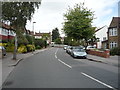
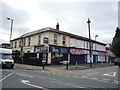
Photos of EN5 9DQ


Area Information
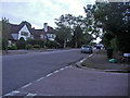
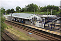
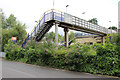
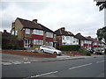
Living in EN5 9DQ means inhabiting a small, tightly knit residential cluster in England, where the population of 1,527 residents creates a quiet, community-focused atmosphere. This area is characterised by its modest size and the prevalence of houses, reflecting a demographic skewed towards adults aged 30–64. The low crime risk, with a safety score of 85, and absence of environmental constraints such as flood zones or protected nature reserves, suggest a stable and secure environment. Proximity to multiple rail and metro stations, including New Barnet and Totteridge & Whetstone, ensures easy access to London’s transport network, while nearby shops like Tesco Barnet and Aldi Brookhill cater to daily needs. EN5 9DQ is ideal for those seeking a balance between suburban tranquillity and urban connectivity, with its compact footprint offering a sense of familiarity without sacrificing practicality.
- Area Type
- Postcode
- Area Size
- Not available
- Population
- Not available
- Population Density
- Not available
EN5 9DQ’s property market is defined by a 75% home ownership rate, with houses forming the majority of accommodation types. This suggests a community where long-term residency is common, and properties are likely to be family homes rather than short-term rentals. The small area’s housing stock is limited, which may mean buyers should consider nearby zones for more options. The focus on owner-occupied homes indicates a stable market, though the lack of flats or apartments could limit choices for those seeking alternative housing. Given the area’s size, property values may reflect local demand for spacious, traditional homes, making it a niche market for buyers prioritising security and established living.
House Prices in EN5 9DQ
No properties found in this postcode.
Energy Efficiency in EN5 9DQ
Daily life in EN5 9DQ is shaped by its proximity to essential amenities. Retail options include Tesco Barnet, Co-op East, and Aldi Brookhill, offering a range of shopping needs within easy reach. The area’s transport links—such as New Barnet Station and Totteridge & Whetstone—facilitate quick access to London’s cultural and economic hubs. While parks and leisure facilities are not explicitly listed, the absence of environmental constraints like AONB or protected woodlands suggests open spaces may be available nearby. The combination of retail convenience, efficient transport, and low crime risk creates a lifestyle that balances practicality with comfort, appealing to those who value accessibility without urban chaos.
Amenities
Schools
| Rank | School | Type | Entry gender | Ages |
|---|
Explore more schools in this area
Go to Schools tabDemographics
EN5 9DQ’s population of 1,527 is predominantly composed of adults aged 30–64, with a median age of 47. This age group defines the community, suggesting a mature, established demographic. Home ownership stands at 75%, indicating a strong presence of owner-occupied properties, which contrasts with the 25% rental market share. The area is characterised by houses rather than flats, aligning with the preference for family-friendly or long-term living. The predominant ethnic group is White, though no specific data on diversity or deprivation is provided. The absence of younger or older age groups may imply a community focused on middle-aged residents, potentially shaping local amenities and social dynamics.
Household Size
Accommodation Type
Tenure
Ethnic Group
Religion
Household Composition
Age
Household Deprivation
NS-SEC
Explore more demographic insights in this area
Go to Demographics tabPlanning
Planning Constraints
- Flood RiskPremium
- Ramsar Wetland SitesPremium
- Area of Outstanding Natural BeautyPremium
- Protected Nature ReservePremium
- Protected WoodlandPremium