Area Overview for EN5 5ST
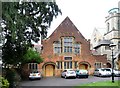
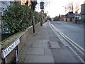
Photos of EN5 5ST


Area Information
EN5 5ST is a small residential postcode area in England, home to 2,610 people. It is a compact cluster of properties, likely centred around a mix of local amenities and transport links. The area’s demographics suggest a mature community, with a median age of 47 and the majority of residents aged 30–64. This indicates a stable, established population, many of whom may be long-term residents. Daily life here is likely shaped by proximity to schools, retail, and public transport, with a focus on practical living rather than sprawling development. The area’s size means it is likely walkable, with residents relying on nearby stations such as High Barnet and Totteridge & Whetstone for commuting. While the population is relatively small, the presence of multiple schools and retail outlets suggests a self-contained community. The housing stock, dominated by flats, reflects a mix of ownership and rental properties, with 50% of homes owner-occupied. This balance may appeal to buyers seeking affordability or investment opportunities in a tightly defined area.
- Area Type
- Postcode
- Area Size
- Not available
- Population
- Not available
- Population Density
- Not available
EN5 5ST’s property market is characterised by a 50% home ownership rate, indicating a mix of owner-occupied and rental properties. The accommodation type is predominantly flats, which may reflect the area’s small size and the practicality of multi-unit housing. This suggests a market that is not dominated by detached homes but rather by apartments or terraced units, likely suited to smaller households or couples. The flat-based stock may appeal to buyers seeking affordability or investors looking for rental income, though the limited area size means competition for properties could be fierce. Given the 50% ownership rate, the area is neither purely a rental hotspot nor entirely owner-occupied, offering a middle ground. Buyers should consider nearby areas for more housing options, as the immediate vicinity may have limited stock. The focus on flats also means potential buyers should evaluate space requirements and long-term suitability for their needs.
House Prices in EN5 5ST
No properties found in this postcode.
Energy Efficiency in EN5 5ST
Residents of EN5 5ST have access to a range of amenities within practical reach. Retail options include Iceland Barnet, Tesco High, and Waitrose Barnet, providing grocery and household essentials. Transport links are robust, with stations such as New Barnet, Hadley Wood, and Oakleigh Park offering rail connections to key destinations. These stations, combined with nearby metro stops, ensure easy access to London’s transport network. While the area lacks large parks or leisure facilities, the presence of multiple retail outlets and transport hubs suggests a lifestyle focused on convenience and connectivity. The mix of shops and stations supports daily errands and commuting, making EN5 5ST a practical choice for those prioritising accessibility over expansive recreational spaces.
Amenities
Schools
Residents of EN5 5ST have access to several schools, including Queen Elizabeth’s Girls’ School, which operates as both a primary and academy with a good Ofsted rating. The Susi Earnshaw Theatre School, an independent institution with a good rating, offers specialist education. The Windmill School, a special needs institution, provides tailored support for students with specific requirements. This mix of school types ensures families have options, from mainstream primary education to specialist provision. The presence of two schools rated ‘good’ by Ofsted suggests a generally strong educational environment, though the absence of secondary schools may require students to attend institutions further afield. Families prioritising diversity in educational settings may find this combination appealing, while those needing special needs support can rely on the Windmill School’s services.
| Rank | School | Type | Entry gender | Ages |
|---|
Explore more schools in this area
Go to Schools tabDemographics
The population of EN5 5ST is 2,610, with a median age of 47. This suggests a community skewed towards adults, particularly those aged 30–64, who make up the most common age range. Home ownership in the area stands at 50%, indicating a balance between owner-occupied and rental properties. The predominant accommodation type is flats, which may reflect the area’s compact nature and limited space for larger homes. The predominant ethnic group is White, though specific data on diversity is not provided. The age profile implies a mature, stable population, possibly with families or individuals in their middle years. With no data on deprivation, it is unclear how economic factors might influence quality of life, but the presence of schools and amenities suggests basic needs are met. The 50% home ownership rate also hints at a rental market that may cater to younger professionals or those seeking flexibility.
Household Size
Accommodation Type
Tenure
Ethnic Group
Religion
Household Composition
Age
Household Deprivation
NS-SEC
Explore more demographic insights in this area
Go to Demographics tabPlanning
Planning Constraints
- Flood RiskPremium
- Ramsar Wetland SitesPremium
- Area of Outstanding Natural BeautyPremium
- Protected Nature ReservePremium
- Protected WoodlandPremium